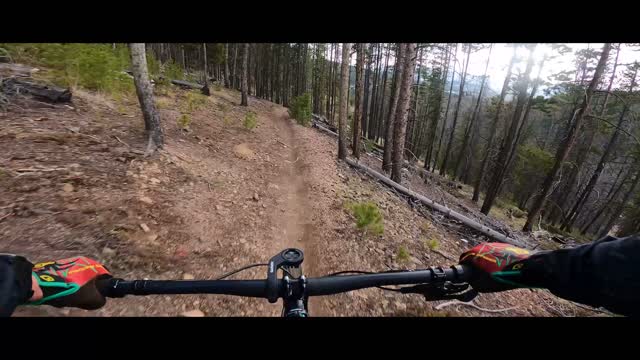
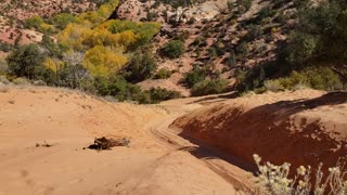
Colorado Trail descent from Muggins Gulch
Segment 6 of the Colorado Trail spans 32.9 miles from Kenosha Pass on HWY 285 to HWY 9 in Breckenridge. This segment of the Colorado trail is the longest climbing nearly 5200 feet and descending over 6000 feet of elevation from point to point. The Muggins Gulch intersection has access the finest views on the trail near the Red Trail junction without climbing up to Georgia Pass.
The Muggins Gulch trailhead is found just over 4 miles up Tiger road from HWY 9 at the gate on Muggings Gulch road. It is also a mile up the road from the Horseshoe Dredge Trailhead. Although Muggins Gulch may not be the best place to park your vehicle for this adventure, it is very easy to find. The best places to park are either the Horseshoe Dredge Parking lot or the parking lot at the end of the trail on Revette Drive.
This trail is epic and is often used with the many other trails that connect to it as a part of loops originating from Breckenridge, Keystone and Dillon. Any way you ride this trail you have a lot of fun! Yield to hikers, runners and through hikers when you see them and enjoy this awesome trail finished in 1987.
Music in the beginning and the end
Lens Distortions Beginnings
Research - Original, Melody, Bass and Percussion, Strings and Undertones
Inventing - Original, Melody, Bass and Percussion, Strings and Undertones
-
 1:48
1:48
Trails and Road rides and Cross Training Adventures
4 years agoWinter Fat Biking down Gold Run road to Preston Town site
275 -
 0:50
0:50
Creative Liberty
4 years agoThe Creative Liberty Podcast : Colorado Trail Hiker : Mike Burkett
201 -
 16:24
16:24
Trails and Road rides and Cross Training Adventures
4 years ago $0.01 earnedHiking The Gore Trail - Copper to Silverthorne Colorado
1244 -
 1:08
1:08
KMGH
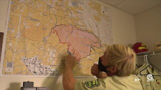
4 years agoWoman finds renewed gratitude while setting Colorado Trail record
113 -
 0:22
0:22
jdecker56
4 years agoHappy Dance from Colorado
45 -
 0:20
0:20
ViralHog
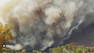
4 years agoSmoke From Colorado Fire Darkens the Sky
182 -
 1:35
1:35
WPTV
4 years agoForest ranger back from Colorado
9 -
 2:57
2:57
KMGH
4 years agoCrumbs from the table: Colorado small businesses receive chump from PPP
15 -
 53:56
53:56
KMGH
4 years agoOct. 2 update on COVID-19 in Colorado from Greeley
22 -
 0:23
0:23
UTVrides
4 years agoBarracks Trail Climb From The Virgin River
272