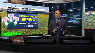
NBC26 Storm Shield Forecast
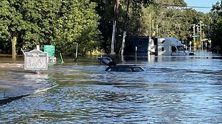
This rain or a few T-storms will continue tonight. A widespread 0.50"-1.00" is likely across N.E.W. which could aggravate ongoing flooding & produce additional flooding. That may start to change to a little snow as we head into Friday morning with some accumulation possible by then....dusting - 2". This looks like a decent rain- and wind-maker kicking up the rivers and moving ice around on Lake Winnebago and the Bay into Friday. A few strong storms are also possible with even a small hail & wind threat. Behind the storm we can expect gusty NW winds to around 40-45 mph. Ice shoves are possible along the eastern shoreline of Green Bay & Lake Winnebago. However this storm tracks, after it exits the region, temperatures will fall into the teens by Saturday Morning with highs possibly not breaking the freezing mark for daytime highs. This should be short lived as more seasonable temperatures returning Sunday
-
 3:49
3:49
WGBA
4 years agoNBC26 Storm Shield Forecast
7 -
 3:49
3:49
WGBA
4 years agoNBC26 Storm Shield Forecast
26 -
 9:45
9:45
Great Lakes Weather
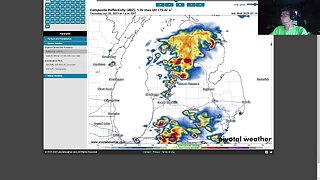
8 months agoIsolated Severe Storms Possible Tomorrow, Cooler Weather Ahead -Great Lakes Weather
4 -
 10:34
10:34
Great Lakes Weather
9 months agoThunderstorms Tuesday; Quiet Pattern Ahead with Gradual Warming Trend -Great Lakes Weather
4 -
 32:59
32:59
Great Lakes Weather
10 months agoLive SEVERE WEATHER BRIEFING for Michigan, Indiana, Ohio
2 -
 24:06
24:06
WeathermanPlus
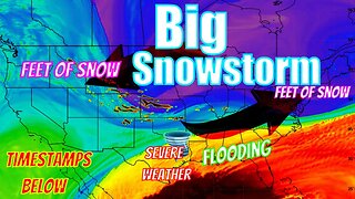
6 months agoMultiple Snowstorms Coming Bringing Feet Of Snow Potentially!
1791 -
 2:16
2:16
Mohibbanchannels
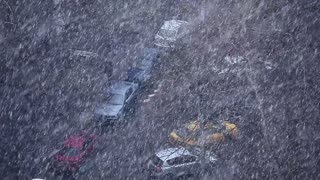
3 months agoThundersnow Storm
251 -
 1:25:10
Off-Grid Backcountry Adventures
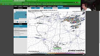
2 years agoLarge Hail, High Winds Forecasted - Let's Livestream! (check out forecast in description below)
36 -
 29:49
29:49
Great Lakes Weather
11 months agoLive Update on Supercell Sunday Severe Weather Potential in Indiana and Ohio
1 -
 1:34
1:34
AmericanNewsBullet
4 months agoBreaking News: Northeast USA Braces for Severe Winter Storm | Latest Updates
19