NBC26 Storm Shield Forecast
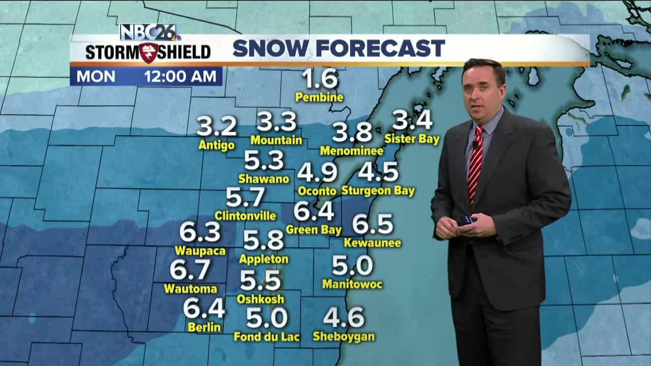
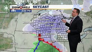
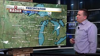
A cold front passing through overnight will bring snow showers and flurries. A dusting to an 1", with a few isolated higher totals will be possible under any snow shower. Saturday looks cooler highs in the low/mid-20s with a few flurries or snow showers are possible still possible. A more potent system will move across the area on Sunday. There is still some uncertainty exactly where the heaviest snow band will fall, but at the moment, a preliminary 4-7" are possible with the highest totals to the far SW, and lower totals north. This forecast most likely will change a bit as new data comes in. A little snow is possible next week Wednesday with some much colder air here by Wednesday night into Thursday. February is the third snowiest month of the year......we typically see 9.9" of snow during the month.
-
 1:45
1:45
WGBA
2 years agoFond du Lac Cardinals start the football season with a new $5.3 million nest
399 -
 3:20
3:20
WGBA
5 years agoNBC26 Storm Shield Forecast
5 -
 3:55
3:55
WGBA
5 years agoNBC26 Storm Shield Forecast
15 -
 1:57
1:57
WGBA
5 years agoNBC26 Storm Shield Forecast
17 -
 4:02
4:02
WGBA
5 years agoNBC26 Storm Shield Forecast
37 -
 2:09
2:09
WGBA
5 years agoNBC26 Storm Shield Forecast
10 -
 3:49
3:49
WGBA
5 years agoNBC26 Storm Shield Forecast
26 -
 2:04
2:04
WGBA
5 years agoNBC26 Storm Shield Forecast
14 -
 4:09
4:09
WGBA
5 years agoNBC26 Storm Shield Forecast
24 -
 1:18
1:18
WGBA
5 years agoNBC26 Storm Shield Forecast
13