NBC26 Storm Shield Forecast
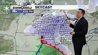
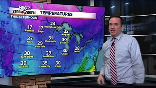
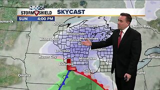
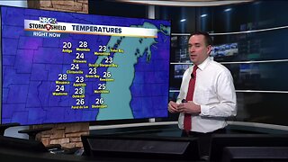
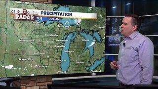
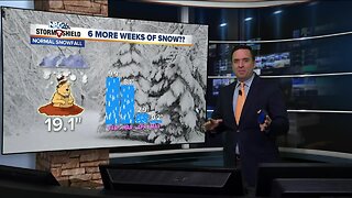
A weak disturbance will be passing this afternoon into the evening bringing a few scattered snow showers and flurries. A dusting to an 1", with a few isolated higher totals will be possible under any snow shower. Highs will be in the upper-20s. Tonight will be a little colder with lows in the single digits. Saturday looks cooler highs in the low/mid-20s with a few flurries still possible. A more potent system will move across the area on Sunday. There is still some uncertainty exactly where the heaviest snow band will fall, but at the moment, a preliminary 3-6" are possible with the highest totals to the far SW, and lower totals north. This forecast most likely will change a bit as new data comes in. Wind will NOT be a problem with this snow and the snow should taper off into the evening. A little snow is possible next week Wednesday with some much colder air here by Wednesday night into Thursday. February is the third snowiest month of the year......we typically see 9.9" of snow during the month.
-
 3:36
3:36
WGBA
7 months agoWill it be necessary to have both the AC & the heat on during the same day??
991 -
 3:20
3:20
WGBA
4 years agoNBC26 Storm Shield Forecast
5 -
 3:55
3:55
WGBA
4 years agoNBC26 Storm Shield Forecast
15 -
 4:02
4:02
WGBA
4 years agoNBC26 Storm Shield Forecast
33 -
 2:09
2:09
WGBA
4 years agoNBC26 Storm Shield Forecast
9 -
 3:49
3:49
WGBA
4 years agoNBC26 Storm Shield Forecast
26 -
 2:04
2:04
WGBA
4 years agoNBC26 Storm Shield Forecast
14 -
 4:09
4:09
WGBA
4 years agoNBC26 Storm Shield Forecast
24 -
 1:18
1:18
WGBA
4 years agoNBC26 Storm Shield Forecast
13 -
 3:56
3:56
WGBA
4 years agoNBC26 Storm Shield Forecast
15