NBC26 Storm Shield Forecast
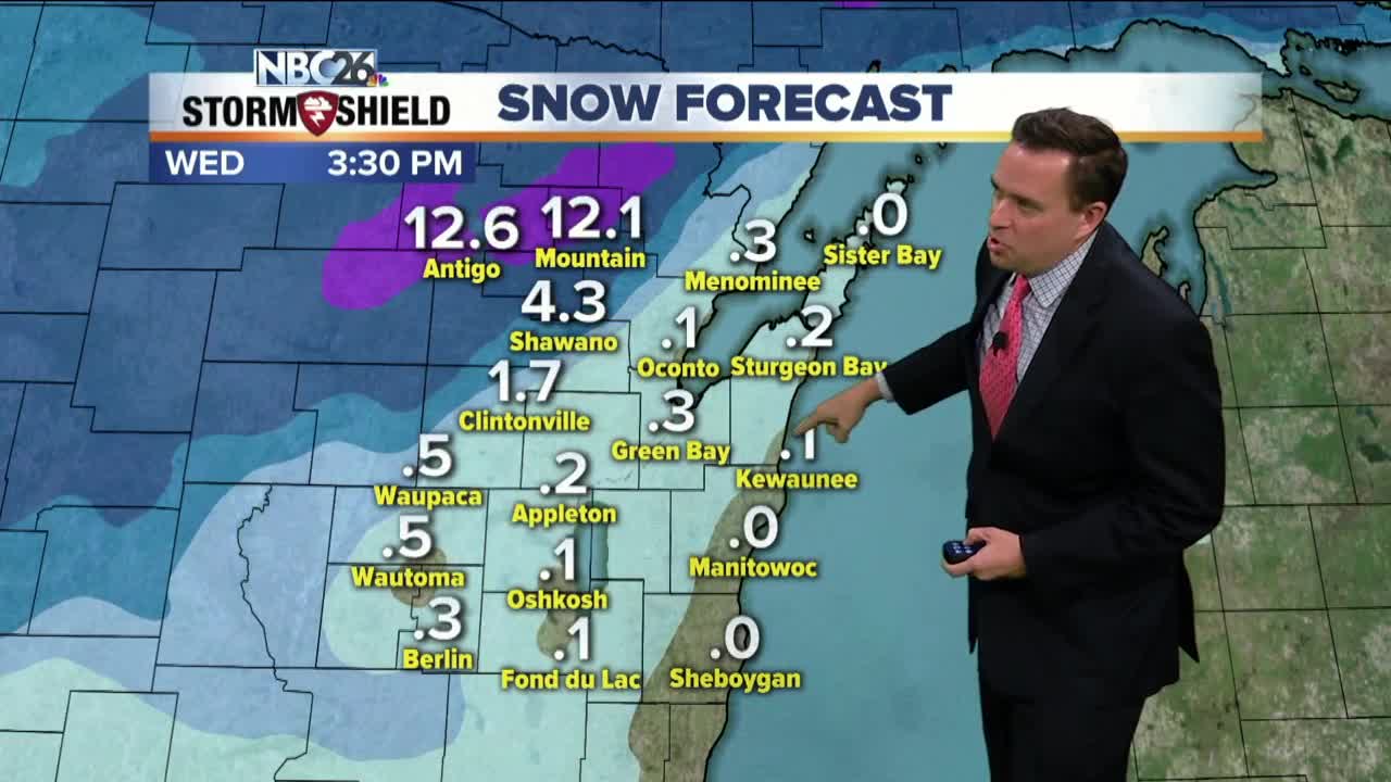
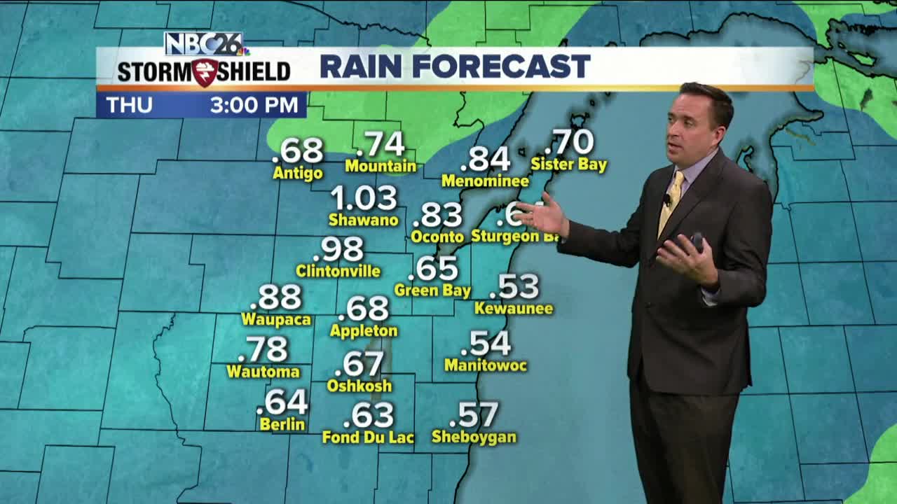
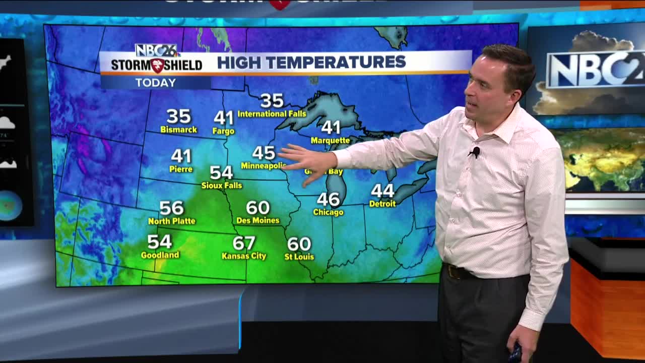
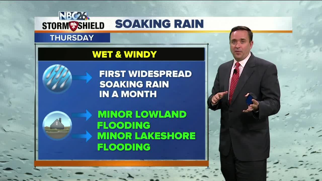
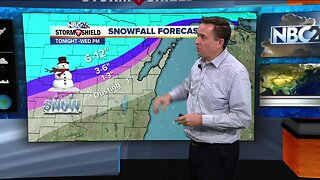
A strong area of low pressure will move across the area tonight & Wednesday. With the track of the low right over N.E.W......most areas from the Fox Valley SE will see rain. Basically, the farther you live to the north and northwest, the more snow you're going to see. This starts out as a rain/snow mix for Green Bay and the Fox Cities, then turns to mainly just rain. However, if you live well off to the N and NW, this is going to be a mainly snow event as we head into Wednesday, before tapering off through the afternoon. Far off to the N and NW, you will see 6-12" . Highs Wednesday will be in the low-40s before falling in the afternoon. Gusty NE winds Tuesday night might produce some Lakeshore & Bay flooding. Gusty NW winds to around 50 mph are possible on Wednesday. Thanksgiving looks quiet & dry. Gobble Gobble!! A wintry mix or snow will develop late Friday with highs in the mid/upper-30s. Another strong system next weekend is something to monitor as well. It's far too early to tell how exactly they will affect us, but once again, it looks to be snowier the farther north you live.
-
 3:36
3:36
WGBA
1 year agoWill it be necessary to have both the AC & the heat on during the same day??
2651 -
 3:20
3:20
WGBA
5 years agoNBC26 Storm Shield Forecast
5 -
 4:10
4:10
WGBA
5 years agoNBC26 Storm Shield Forecast
18 -
 3:17
3:17
WGBA
5 years agoNBC26 Storm Shield Forecast
14 -
 4:14
4:14
WGBA
5 years agoNBC26 Storm Shield Forecast
25 -
 1:37
1:37
WGBA
5 years agoNBC26 Storm Shield Forecast
17 -
 3:59
3:59
WGBA
5 years agoNBC26 Storm Shield Forecast
18 -
 1:48
1:48
WGBA
5 years agoNBC26 Storm Shield Forecast
10 -
 1:36
1:36
WGBA
5 years agoNBC26 Storm Shield Forecast
18 -
 5:23
5:23
WGBA
5 years agoNBC26 Storm Shield Forecast
10