NBC26 Storm Shield Forecast
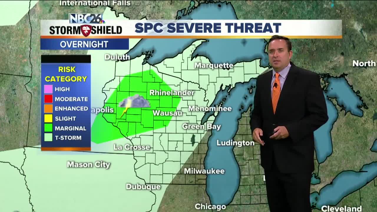
A cold front approaching from the NW will touch off a few showers or T'storms late tonight with lows only in the mid-60s. The chance of scattered showers or a few T'storms will continue into Thursday AM. Sun & clouds return by afternoon with warm highs again in the upper-70s to lower 80s. There will be a slight chance of a T'storm Friday, but as of this moment, it looks like most of the day should be okay with warm highs again in the low-80s. It will be cooler by the lake again. We'll have a chance of T'storms Saturday, but there's still some uncertainty on when a system departs on Sunday. If it can do so faster, we'd keep the rain chances to the morning hours. It's a little too early to tell. We only need another 0.66" of rain to have the wettest September on record......we may see that amount by week's end. Astronomical fall officially arrives on Monday.
-
 1:45
1:45
WGBA
1 year agoFond du Lac Cardinals start the football season with a new $5.3 million nest
231 -
 1:26
1:26
WSYM
2 years agoToday's Forecast: Scattered shower and storm chances
3 -
 3:39
3:39
WGBA
2 years agoGino Recchia NBC26 Weather Forecast
1 -
 3:41
3:41
WGBA
2 years agoGino Recchia NBC26 Weather Forecast
4 -
 3:51
3:51
WGBA
2 years agoGino Recchia NBC26 Weather Forecast
1 -
 2:45
2:45
WGBA
2 years agoGino Recchia NBC26 Weather Forecast
5 -
 3:42
3:42
WGBA
2 years agoGino Recchia NBC26 Weather Forecast
4 -
 3:37
3:37
WGBA
2 years agoGino Recchia NBC26 Weather Forecast
4 -
 3:14
3:14
WGBA
2 years agoGino Recchia NBC26 Weather Forecast
5 -
 3:14
3:14
WGBA
2 years agoGino Recchia NBC26 Weather Forecast
1