Gino Recchia NBC26 Weather Forecast
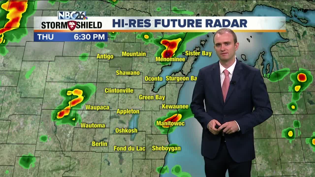
As we head into the evening, the pop up thunderstorms that have occurred during the daytime hours will begin to wind down, however there is an approaching cold front that will bring in some additional risks of showers of storms to the Northwoods area until late tonight. A marginal risk for severe weather has been highlighted for that area. Temperatures will fall into the upper 60s with light south winds. More scattered showers and T'storms will redevelop on Friday with warm humid highs in the mid/upper-80s again as the cold front continues to push through. A risk for strong storms is possible southwest of the Fox Valley. A few storms will persist into the early morning hours of Saturday, but then we will clear up by the afternoon with temperatures being cooler in the mid and upper 70s. Sunday will be a little warmer with highs in the upper 70s to near 80 degrees. Humidity levels will be lower during the weekend, so if you want to open up the windows, now would be the time to do so before more warmer and humid air returns next week.
-
 3:36
3:36
WGBA
1 year agoWill it be necessary to have both the AC & the heat on during the same day??
2961 -
 3:20
3:20
WGBA
3 years agoGino Recchia NBC26 Weather Forecast
11 -
 3:55
3:55
WGBA
2 years agoGino Recchia NBC26 Weather Forecast
145 -
 3:44
3:44
WGBA
2 years agoGino Recchia NBC26 Weather Forecast
7 -
 4:03
4:03
WGBA
2 years agoGino Recchia NBC26 Weather Forecast
9 -
 3:43
3:43
WGBA
2 years agoGino Recchia NBC26 Weather Forecast
3 -
 4:00
4:00
WGBA
2 years agoGino Recchia NBC26 Weather Forecast
5 -
 3:48
3:48
WGBA
2 years agoGino Recchia NBC26 Weather Forecast
13 -
 4:28
4:28
WGBA
2 years agoGino Recchia NBC26 Weather Forecast
2 -
 3:44
3:44
WGBA
2 years agoGino Recchia NBC26 Weather Forecast
2