Gino Recchia NBC26 Weather Forecast
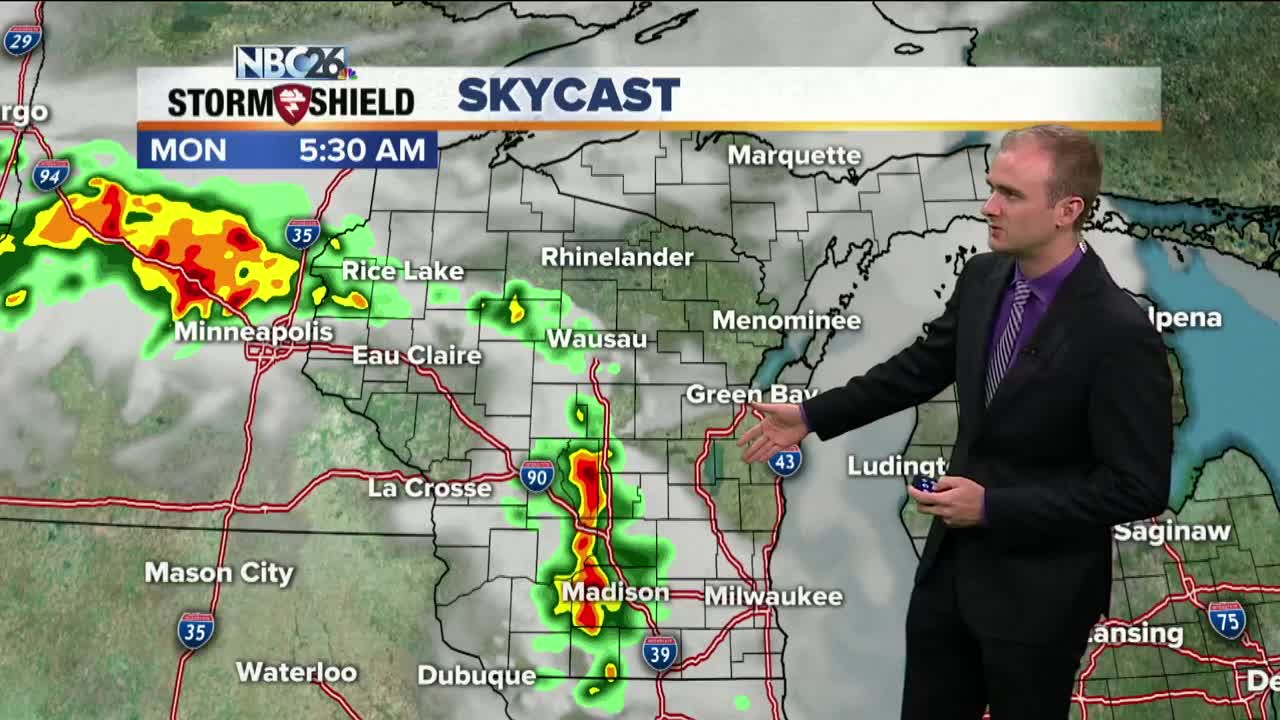
A line of strong thunderstorms came through areas southwest of the Fox Valley this morning bringing some gusty winds to Green Lake and Marquette Counties. There have been a few reports of tree branches taken down from these storms. Another cluster of showers and thunderstorms swept through the area this evening over the same locations, west of the Fox Valley. It is going to be dry for the first half of the overnight with temperatures falling into the mid and upper 60s with calm winds. Into the early morning hours, we are going to monitor the redevelopment of thunderstorms somewhere in western and central Wisconsin. Some of these storms may be strong as they move into the NBC26 viewing area. Michael Fish will be monitoring and updating throughout tomorrow morning. This early morning convection is poised to break down by lunch time, however another round of scattered showers and storms which may be strong will develop later in the afternoon and evening. Temperatures will rise into the lower to mid 80s if we get under some sunshine, otherwise we will remain in the upper 70s under humid conditions and west winds around 5 to 10 mph. The chance of storms will continue on and off through Thursday. Temperatures will fall into the mid 70s during the weekend. This will also drop the humidity down as well.
-
 1:45
1:45
WGBA
1 year agoFond du Lac Cardinals start the football season with a new $5.3 million nest
361 -
 3:20
3:20
WGBA
3 years agoGino Recchia NBC26 Weather Forecast
11 -
 3:44
3:44
WGBA
3 years agoGino Recchia NBC26 Weather Forecast
7 -
 3:43
3:43
WGBA
3 years agoGino Recchia NBC26 Weather Forecast
3 -
 4:00
4:00
WGBA
3 years agoGino Recchia NBC26 Weather Forecast
5 -
 3:48
3:48
WGBA
3 years agoGino Recchia NBC26 Weather Forecast
13 -
 4:28
4:28
WGBA
3 years agoGino Recchia NBC26 Weather Forecast
2 -
 3:44
3:44
WGBA
3 years agoGino Recchia NBC26 Weather Forecast
2 -
 3:48
3:48
WGBA
3 years agoGino Recchia NBC26 Weather Forecast
1 -
 3:40
3:40
WGBA
3 years agoGino Recchia NBC26 Weather Forecast
2