NBC26 Storm Shield weather forecast
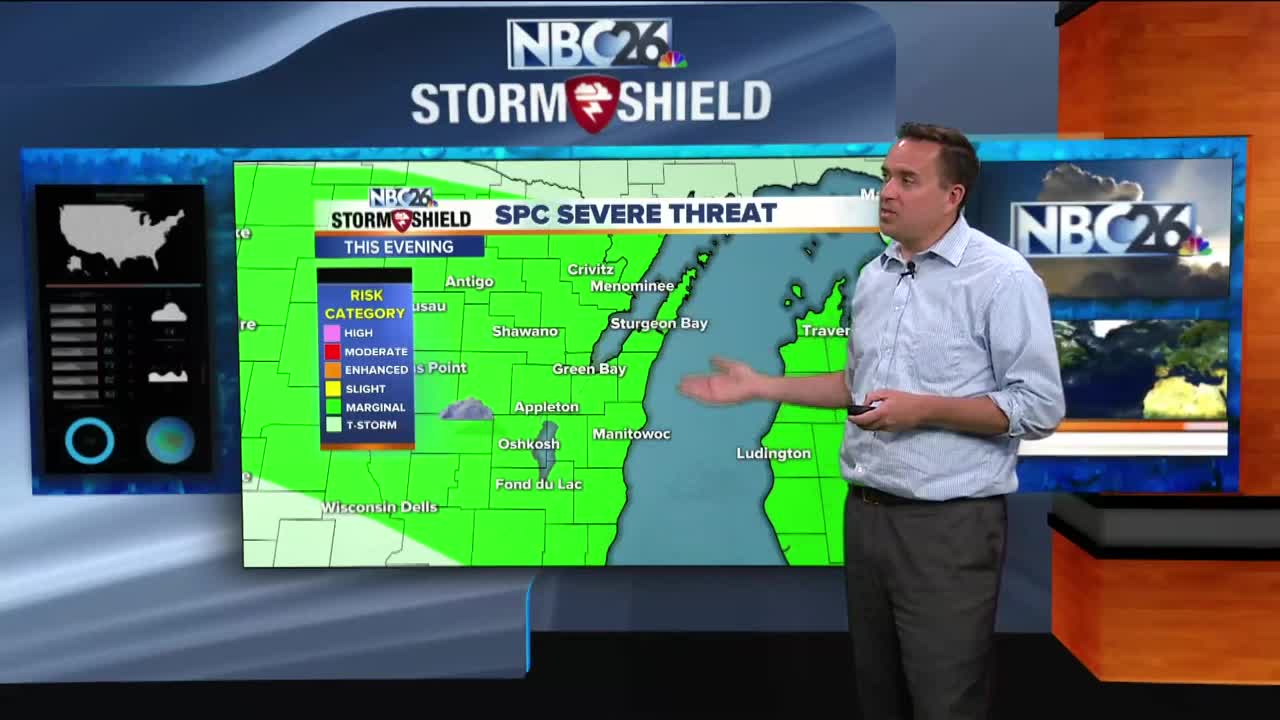
Get ready for a breezy and warm Friday with highs in the mid 80s to lower 90s. A cold front will be approaching from the NW during the evening & will touch off some thunderstorms. With this setup, the amount of humidity is going to be key as to how strong these get. Either way, it looks like most of the development should start to the north as the afternoon wears on. If we have enough humidity, some of these storms could produce some strong winds or hail. That front will be slowly sliding south through the evening with scattered T'storms becoming more numerous along it. Again, if it's humid enough, some of these storms could be strong to severe with strong winds and hail being the main threats. We'll have overnight lows in the mid-50s. Along with the chance of some showers and T'storms, we'll be cooler with highs in the mid- to upper-60s on Saturday. Saturday night should be quiet with lows in the mid-40s. Sunday will be mainly sunny with the upper 60s to lower 70s. There is a small chance of shower across the north during the early evening. As far as weather records are concerned Saturday is the first day of Meteorological Summer.
-
 1:57
1:57
WGBA
1 year agoHow the City of Green Bay is hoping a $1.6M investment will make the community safer for pedestrians
3091 -
 3:20
3:20
WGBA
3 years agoGino Recchia NBC26 Weather Forecast
11 -
 3:29
3:29
WGBA
3 years agoGino Recchia NBC26 Weather Forecast
-
 1:41
1:41
WGBA
3 years agoGino Recchia NBC26 Weather Forecast
7 -
 4:51
4:51
WGBA
3 years agoGino Recchia NBC26 Weather Forecast
2 -
 2:44
2:44
WGBA
3 years agoGino Recchia NBC26 Weather Forecast
3 -
 3:03
3:03
WGBA
3 years agoGino Recchia NBC26 Weather Forecast
-
 3:51
3:51
WGBA
3 years agoGino Recchia NBC26 Weather Forecast
6 -
 2:56
2:56
WGBA
3 years agoGino Recchia NBC26 Weather Forecast
-
 3:32
3:32
WGBA
3 years agoGino Recchia NBC26 Weather Forecast