Michael Fish's NBC26 weather forecast
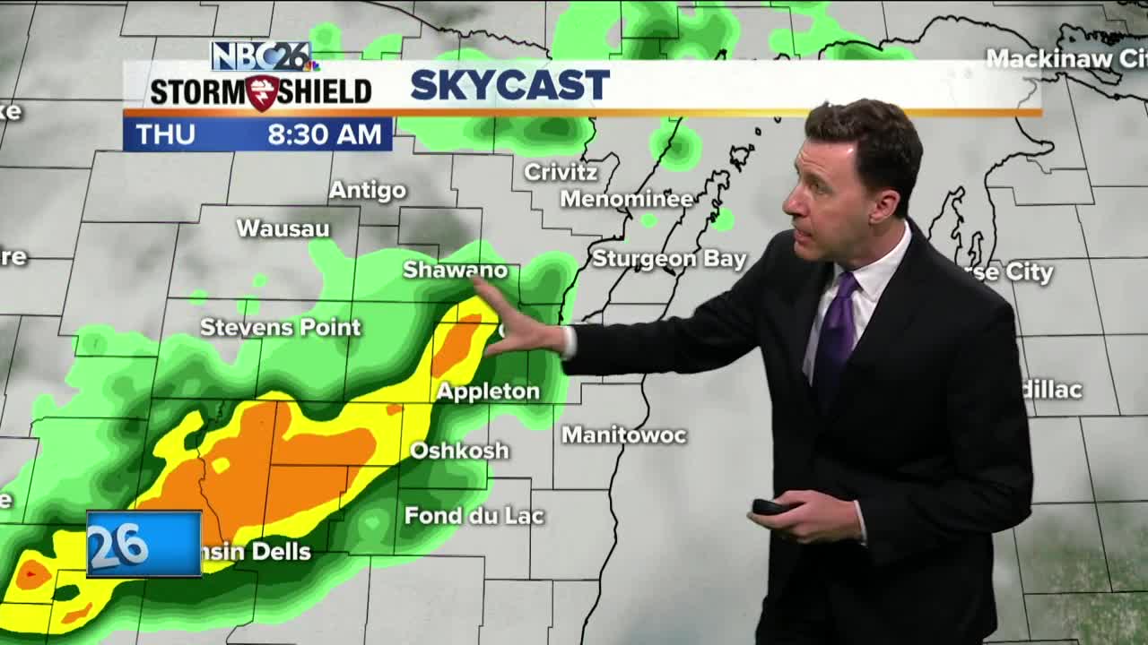
Today will start off with a round of showers & storms. Skies will become partly to mostly sunny by afternoon with temps warming into the upper-70s to possibly 80. Additional scattered showers & T'storms are possible during the later afternoon or evening. Although the best chance for organized severe weather will remain to our south..... gusty wind or some hail can not be ruled out. Some of us will see a few scattered showers and T'storms in the evening as a cold front passes through. This will come to an end though, then we may have some partial clearing after that with lows in the upper-40s. Most of Friday looks dry, but a little cooler with highs only in the upper-50s to low-60s, though cooler lakeside. There will be a slight chance of a shower or T'storm, mainly south. Most of the activity starts to arrive as we head through Friday night. Rain will be rolling through at times during the weekend weekend making it potentially another soggy stretch for Northeast Wisconsin. As of right now, Saturday will have some showers developing or possibly a T'storm, but it shouldn't be a total wash. Sunday may be the rainier of the two weekend days. Depending on where the frontal boundary sets up over the weekend......highs will range form the 40s/50s/60s to the 70s/80s farther south in Wisconsin. As of right now, it looks like Northeast Wisconsin will probably stay on the cooler side of this, but with the warm air close, we still may have a T'storm embedded with the rain.
-
 0:30
0:30
WGBA
1 year agoThree Degree Guarantee
339 -
 3:20
3:20
WGBA
3 years agoGino Recchia NBC26 Weather Forecast
11 -
 3:06
3:06
WGBA
3 years agoGino Recchia NBC26 Weather Forecast
1 -
 3:18
3:18
WGBA
3 years agoGino Recchia NBC26 Weather Forecast
7 -
 2:33
2:33
WGBA
4 years agoMichael Fish's NBC 26 weather forecast
4 -
 3:00
3:00
WGBA
3 years agoGino Recchia NBC26 Weather Forecast
4 -
 2:19
2:19
WGBA
4 years agoMichael Fish's NBC 26 weather forecast
3 -
 2:26
2:26
WGBA
4 years agoMichael Fish's NBC 26 weather forecast
4 -
 2:24
2:24
WGBA
4 years agoMichael Fish's NBC 26 weather forecast
3 -
 1:57
1:57
WGBA
4 years agoMichael Fish's NBC 26 weather forecast
2