NBC26 Storm Shield weather forecast
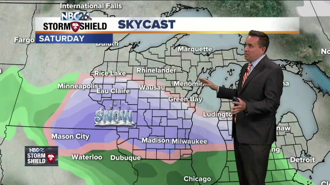
It was another beautiful day across the area with highs (way form Lake Michigan) in the 60s & 70s. The normal high is 58°. A cold front will approach the area on Thursday. At the same time an area of low pressure will ride NE along that front towards the area. The end result will be more clouds than the last couple of days & showers by the afternoon. Highs will range from the upper 50s (SW) to the mid/upper-60s (NW). Friday looks windy and seasonable with plenty of sun and highs in the upper 50s to lower 60s. Saturday will be windy & cold with a wintry mix or snow. Accumulating snow is likely with this storm.....the big questions right now are where & how much?? Stay tuned. Dry weather returns on Sunday but temps will be running 10-15° below normal. The cooler temps will linger into early May!!
-
 1:45
1:45
WGBA
2 years agoFond du Lac Cardinals start the football season with a new $5.3 million nest
390 -
 4:05
4:05
WGBA
3 years agoGino Recchia NBC26 Weather Forecast
1 -
 3:39
3:39
WGBA
3 years agoGino Recchia NBC26 Weather Forecast
1 -
 3:46
3:46
WGBA
3 years agoGino Recchia NBC26 Weather Forecast
7 -
 3:02
3:02
WGBA
3 years agoGino Recchia NBC26 Weather Forecast
4 -
 2:30
2:30
WGBA
3 years agoGino Recchia NBC26 Weather Forecast
71 -
 3:46
3:46
WGBA
3 years agoGino Recchia NBC26 Weather Forecast
6 -
 3:34
3:34
WGBA
3 years agoGino Recchia NBC26 Weather Forecast
6 -
 2:57
2:57
WGBA
3 years agoGino Recchia NBC26 Weather Forecast
1 -
 3:45
3:45
WGBA
3 years agoGino Recchia NBC26 Weather Forecast
1