Michael Fish's NBC26 Storm Shield weather forecast
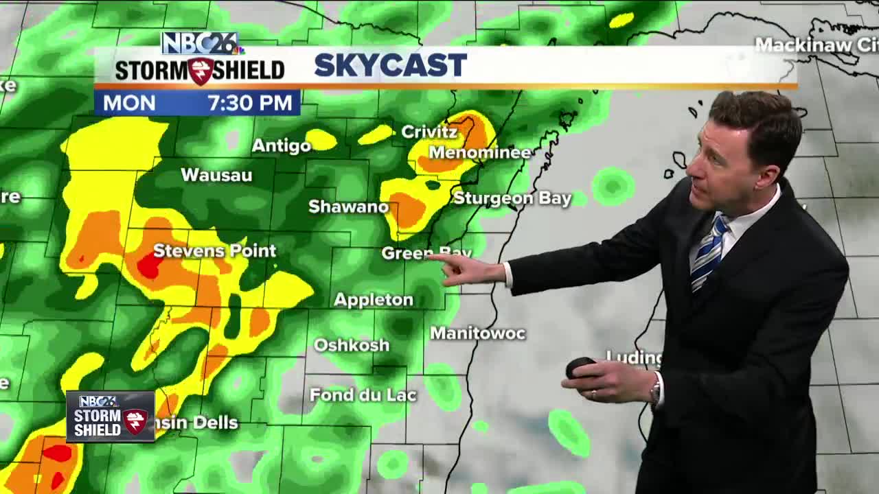
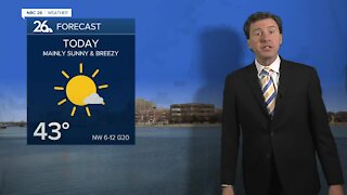
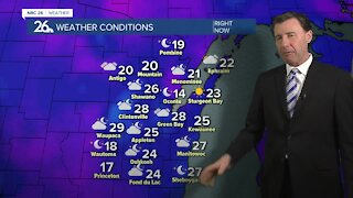
More clouds will return for today with the chance of showers & T'storms going way up by later this afternoon. The rain could be locally heavy & aggravate the flooding we've been seeing across the area......so a Flood Watch has been issued for much of the area. Highs will range from the 50s NE to the 70s SW. Areas of showers and T'storms will be rolling through with the potential of more locally heavy downpours running into the already swollen rivers. Overnight lows will be in the low-40s. Tuesday will improve with the sun coming back, but it will be windy. Highs will top out in the upper-50s. Tuesday night looks dry with the winds becoming light. Lows will be in the mid-30s. Wednesday should be a pretty nice day with highs in the mid-60s with sun.
-
 1:45
1:45
WGBA
1 year agoFond du Lac Cardinals start the football season with a new $5.3 million nest
254 -
 2:33
2:33
WGBA
3 years agoMichael Fish's NBC 26 weather forecast
4 -
 2:19
2:19
WGBA
3 years agoMichael Fish's NBC 26 weather forecast
3 -
 2:26
2:26
WGBA
3 years agoMichael Fish's NBC 26 weather forecast
4 -
 2:24
2:24
WGBA
3 years agoMichael Fish's NBC 26 weather forecast
3 -
 2:27
2:27
WGBA
3 years agoMichael Fish's NBC 26 weather forecast
4 -
 1:57
1:57
WGBA
3 years agoMichael Fish's NBC 26 weather forecast
2 -
 2:31
2:31
WGBA
3 years agoMichael Fish's NBC 26 weather forecast
7 -
 1:50
1:50
WGBA
3 years agoMichael Fish's NBC 26 weather forecast
4 -
 2:27
2:27
WGBA
3 years agoMichael Fish's NBC 26 weather forecast
1