Gino Recchia NBC26 Storm Shield Weather Forecast
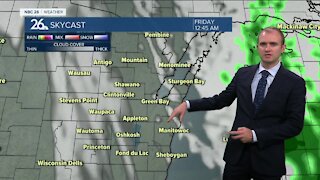
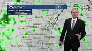
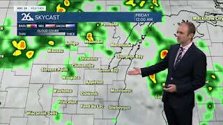
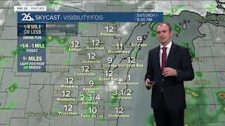
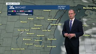
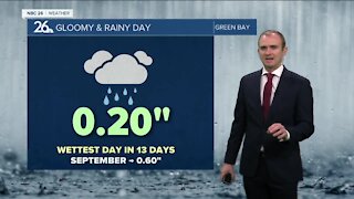
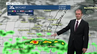
You will want the rain gear today because it is going to be a raw day out with rounds of heavy showers and thunderstorms moving through the area. A strong low pressure is surging a lot of moisture from the Gulf of Mexico into the Midwest. There will be enough instability that some storms could be severe over Southwest part of the area near Marquette and Green Lake Counties. Some storms could be capable of small hail and gusty winds. On the topic of gusty winds, it will be a breezy day with northeast winds picking up by the afternoon between 10 and 20 mph and with temperatures expected to be in the lower 40s by the lake and upper 40s inland, it is not going to be too pleasant but at least it will make the grass green. Tonight most of the showers and storms will come to an end but a few light rain showers will be possible throughout the rest of the night and into the day tomorrow. Temperatures will fall into the lower 40s tonight with winds changing out of the northwest between 10 to 15 mph. Scattered rain showers will remain in place Thursday with high temperatures in the mid 40s and winds out of the north and northwest around 10 to 15 mph. Skies will begin to clear overnight into Friday with sunshine returning and temperatures back in the upper 50s. The weekend looks pleasant with temperatures in the lower 60s on Saturday and mid 60s on your Easter Sunday.
-
 1:45
1:45
WGBA
7 months agoFond du Lac Cardinals start the football season with a new $5.3 million nest
65 -
 4:05
4:05
WGBA
2 years agoGino Recchia NBC26 Weather Forecast
1 -
 3:46
3:46
WGBA
2 years agoGino Recchia NBC26 Weather Forecast
3 -
 3:45
3:45
WGBA
2 years agoGino Recchia NBC26 Weather Forecast
1 -
 3:45
3:45
WGBA
2 years agoGino Recchia NBC26 Weather Forecast
10 -
 2:30
2:30
WGBA
2 years agoGino Recchia NBC26 Weather Forecast
71 -
 3:40
3:40
WGBA
2 years agoGino Recchia NBC26 Weather Forecast
1 -
 3:34
3:34
WGBA
2 years agoGino Recchia NBC26 Weather Forecast
4 -
 2:57
2:57
WGBA
2 years agoGino Recchia NBC26 Weather Forecast
1 -
 3:30
3:30
WGBA
2 years agoGino Recchia NBC26 Weather Forecast
12