NBC26 Storm Shield weather forecast
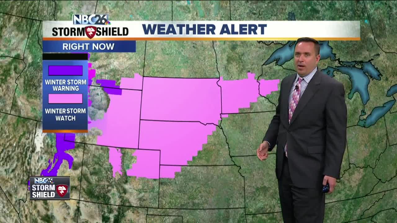
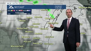
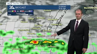
With highs in the 60s & 70s Monday was the wares day since October!! Temperatures are back in the 50s on Tuesday with mostly dry, but breezy conditions. There could be a shower well to the north. The potential for a major winter storm across the Midwest is turning more and more likely as we get closer to the event. We still have almost 60 hours to go before it gets here, so the forecast will likely change as it gets closer. Right now it appears Wednesday will be dry for at least the first half of the day with just a chance of some snow in the later afternoon. The main brunt of the storm looks like it will start on Wednesday night as snow becomes more widespread & heavy. By the time you wake up on Thursday, there looks like a fairly good likelihood that we'll have a significant amount of snow on the ground. It will be heavy, wet snow. This will continue into the first half of Thursday. As a warm front lifts through the whole area, the snow couldl turn over to a mix temperatures remaining in the lower/mid 30s. This mix will change back over to a little snow as Thursday night progresses. Measuring this snow could be quite tricky as the snow will be melting from the bottom with the mild ground, and from the top with the above freezing temps and possible mix falling on top. There could be quite a bit of snow that falls out of this, but as of this moment, it doesn't look quite as big as last April's blizzard. We'll start to give you some estimated snow totals as this event gets closer On Friday, the storm will begin to push out of the area with wrap around snow showers and temperatures once again in 30s to around 40. Temperatures do go back into the 40s to around 50 for the weekend with dry conditions.
-
 1:45
1:45
WGBA
1 year agoFond du Lac Cardinals start the football season with a new $5.3 million nest
358 -
 4:05
4:05
WGBA
3 years agoGino Recchia NBC26 Weather Forecast
1 -
 2:30
2:30
WGBA
3 years agoGino Recchia NBC26 Weather Forecast
71 -
 3:34
3:34
WGBA
3 years agoGino Recchia NBC26 Weather Forecast
6 -
 2:57
2:57
WGBA
3 years agoGino Recchia NBC26 Weather Forecast
1 -
 3:30
3:30
WGBA
3 years agoGino Recchia NBC26 Weather Forecast
14 -
 2:55
2:55
WGBA
3 years agoGino Recchia NBC26 Weather Forecast
5 -
 3:22
3:22
WGBA
3 years agoGino Recchia NBC26 Weather Forecast
2 -
 3:24
3:24
WGBA
3 years agoGino Recchia NBC26 Weather Forecast
2 -
 2:53
2:53
WGBA
3 years agoGino Recchia NBC26 Weather Forecast
1