NBC26 Storm Shield weather forecast
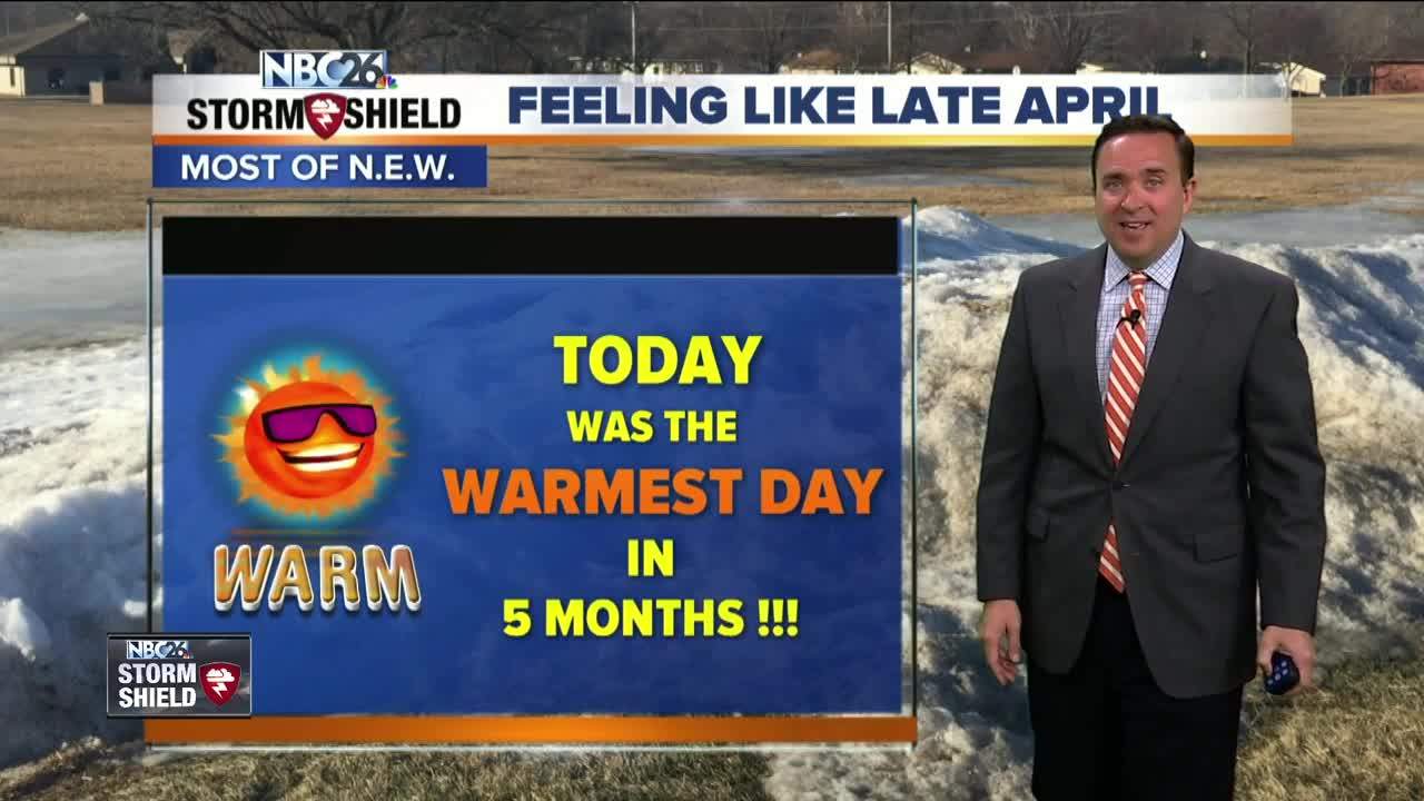
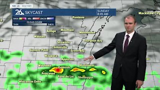
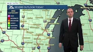
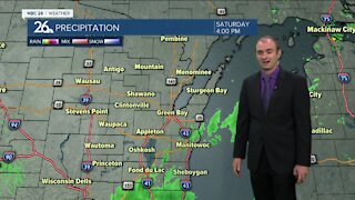
With strong & gusty SW winds......Wednesday was the warmest day in 5 months!! High temps (away from the lake) were in the 50s & 60s! Tonight, the cold front will swing through and that will change winds out of the west and northwest. Temperatures will drop into lower 40s under mostly cloudy conditions. A sprinkle is possible. The clouds do stick around for our Thursday with temperatures being slightly cooler in the lower/mid 50s but still above average for this time of the year where our highs should be in the mid-40s. Winds will be coming in out of the northwest around 10-20 mph. On Friday.......temperatures will be slightly cooler than Thursday with highs in the upper 40s to near 50 degrees. Skies will remain partly cloudy to mostly cloudy. There is a developing storm that will move north from the Southern Plains but a strong high pressure to our northwest will be acting as a block, preventing it from moving into the Upper Midwest. It does appear right now the best chance of rain and or wintry mix will remain over Southern Wisconsin with Northeast Wisconsin just seeing the cloudy skies. High temperatures will be in the lower 40s on Saturday and Sunday. With winds blowing out of the north and northeast, lakeside areas will be slightly cooler than inland locations.
-
 1:45
1:45
WGBA
1 year agoStudents excited to start at "huge and beautiful" Vel Phillips Middle School
255 -
 3:30
3:30
WGBA
3 years agoGino Recchia NBC26 Weather Forecast
12 -
 2:55
2:55
WGBA
3 years agoGino Recchia NBC26 Weather Forecast
5 -
 3:24
3:24
WGBA
3 years agoGino Recchia NBC26 Weather Forecast
2 -
 2:53
2:53
WGBA
3 years agoGino Recchia NBC26 Weather Forecast
1 -
 3:32
3:32
WGBA
3 years agoGino Recchia NBC26 Weather Forecast
6 -
 3:13
3:13
WGBA
3 years agoGino Recchia NBC26 Weather Forecast
5 -
 3:24
3:24
WGBA
3 years agoGino Recchia NBC26 Weather Forecast
1 -
 3:14
3:14
WGBA
3 years agoGino Recchia NBC26 Weather Forecast
3 -
 3:54
3:54
WGBA
3 years agoGino Recchia NBC26 Weather Forecast
2