NBC26 Storm Shield weather forecast
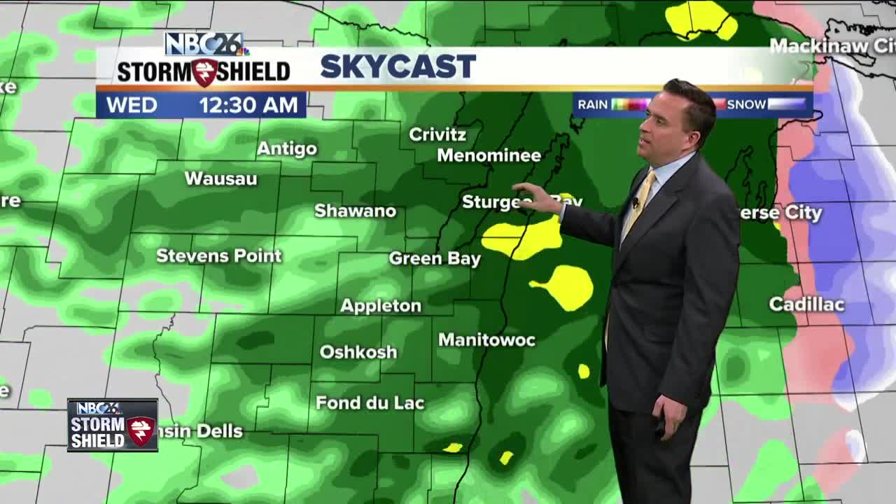
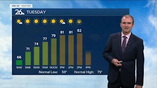
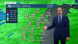
**FLOOD WATCH** We have a relatively slow-moving low pressure on the way that will affect us starting tonight. Slowly rain will start to develop as the night goes on. With the milder temps over the cold snowpack, we could start to see some fog developing around the area over the next several days. Lows will be mild in the mid/upper-30s and rising a bit. Wednesday will be mild again with fog possible. There could be a few scattered showers or sprinkles, but this does not look to be an all-day rain. Highs will be in the mid/upper-40s. More showers will be moving through on Wednesday night with areas of fog and mild temps. Lows will be around 40. Showers and maybe a rumble of thunder will be the story for Thursday into Thursday night. It will be a "warm" day for this time of year with highs in the upper-50s to lower 60s......of course it will be cooler near the lake. With the melting snow and mild temps we will also see areas of dense fog & the potential for some flooding with the rainfall possibly around 1". We cool off Friday with highs in the mid/upper-30s with a risk of a few flurries or some light rain or snow showers early as this system moves away. The weekend looks cooler with temperatures near average in the upper-30s to around 40 each day. Some light snow is possible late Sunday. If we manage to hit the 60 degree mark, it will be the warmest day since late October, almost 5 months ago.
-
 1:45
1:45
WGBA
1 year agoStudents excited to start at "huge and beautiful" Vel Phillips Middle School
358 -
 3:24
3:24
WGBA
3 years agoGino Recchia NBC26 Weather Forecast
2 -
 3:32
3:32
WGBA
3 years agoGino Recchia NBC26 Weather Forecast
6 -
 3:54
3:54
WGBA
3 years agoGino Recchia NBC26 Weather Forecast
2 -
 2:46
2:46
WGBA
3 years agoGino Recchia NBC26 Weather Forecast
2 -
 3:24
3:24
WGBA
3 years agoGino Recchia NBC26 Weather Forecast
2 -
 2:54
2:54
WGBA
3 years agoGino Recchia NBC26 Weather Forecast
3 -
 2:41
2:41
WGBA
3 years agoGino Recchia NBC26 Weather Forecast
2 -
 3:11
3:11
WGBA
3 years agoGino Recchia NBC26 Weather Forecast
2 -
 3:14
3:14
WGBA
3 years agoGino Recchia NBC26 Weather Forecast
9