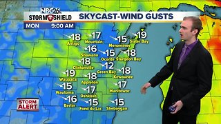
Gino Recchia NBC26 Storm Shield Weather Forecast
4.5 inches of snow fell last night into this morning in Green Bay with some higher totals over 5 inches in some locations. We normally see on average 8.1" of snow for the month of march and after just a day and a half, we have accumulated more than half of the monthly average. We will see what is in store as we continue on. Skies cleared this morning after snowfall ended with temperatures rising into the upper 20s and lower 30s. You can say goodbye to those temperature for at least the next few days. An arctic front is going to move through tonight. A few flurries or a couple passing snow showers are possible along this front. A dusting of snow isn't out of the question if some snow showers do materialize. Winds will shift to the north and northwest overnight as temperatures drop into the single digits Sunday morning. Wind chills will be between -5 to -15 in the morning. Wind chills will be even worse farther north in the Northwoods. A wind chill advisory has been issued for Langlade county with wind chills between -15 to -25 degrees. High temperatures will rise into the lower teens in the afternoon with mostly sunny skies. Monday will be even colder with morning lows between -5 to -15 degrees and high temperatures remaining in the single digits. We will begin a gradual warming trend from Tuesday onward to the weekend. The next chance of snow is Friday. There remains some questions with the track and right now we look to be on the far northern fringe of getting snow. If the storm shifts any further southward, we wont see any. There is another storm on Sunday that may require some monitoring. Long range temperature trends are calling for the return of 30s by the middle of the month. Perhaps a sign of spring weather after all?
-
 3:54
3:54
WGBA
5 years agoGino Recchia NBC26 Storm Shield Weather Forecast
9 -
 2:52
2:52
WGBA
5 years agoGino Recchia NBC26 Storm Shield Weather Forecast
8 -
 18:00
18:00
Great Lakes Weather
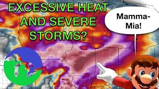
10 months agoHEAT WAVE and Possible Severe Thunderstorms Through the Week -Great Lakes Weather
32 -
 17:25
17:25
Great Lakes Weather
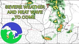
11 months agoSevere Weather Potential Next Week with a Possible Heat Wave To Come -Great Lakes Weather
34 -
 2:16
2:16
Mohibbanchannels
4 months agoThundersnow Storm
271 -
 8:36
8:36
TiffanysContent
5 months agoDaily Weather Update: Snowstorm, Tornadoes, Thunderstorms, LIGHTNING, Heavy Rainfall, Black Ice, FOG
39 -
 26:33
26:33
WeathermanPlus
2 years agoEaster Snowstorm Detailed Forecast, Tornadoes, Major Snowfall & Potential Hurricane Winds!
23 -
 24:06
24:06
WeathermanPlus
7 months agoMultiple Snowstorms Coming Bringing Feet Of Snow Potentially!
2121 -
 12:19
12:19
Great Lakes Weather
2 years agoMore Active Weather Ahead, Thunderstorms AND Snow in One Week -Great Lakes Weather
4 -
 27:44
27:44
Legend813
1 year agoSevere Thunderstorm Warning NOAA Weather Radio Laporte Indiana Sunday June 20 2021
351