Michael Fish's NBC26 winter weather forecast
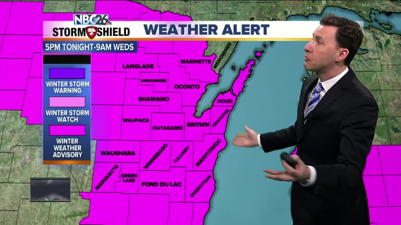
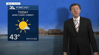
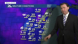
Today, most of the daytime should be okay with the exception of the late afternoon when we could see a few flurries or light snow, but the more significant snow will get here picking up through the evening. Highs today will only be in the mid-teens. Tonight into Wednesday morning will be the main brunt of this system. This will cause some headaches for the Wednesday morning commute especially. Accumulations at this time look to be between 4-6" with 2-4" mainly south of Highway 21. Luckily, it won't be as windy as this past weekend's storm, so blowing and drifting won't be much of an issue. Lows will be around 10 and rising just a bit through the night and highs Wednesday will be in the mid-20s for cleanup. Cold weather will persist on Thursday with the chance of some light snow & flurries. Chances of snow start to increase, especially Friday night into Saturday where more snow accumulation will be possible. FRIGID air moves back in this weekend, especially Sunday. This cold air mass persists into next week and really has no end in the next week or more. If you want spring weather on March 1st, good luck finding that in Northeast Wisconsin. At this rate, perhaps staying in Florida for the time being might be a safer bet.
-
 0:30
0:30
WGBA
1 year agoThree Degree Guarantee
359 -
 2:33
2:33
WGBA
4 years agoMichael Fish's NBC 26 weather forecast
4 -
 2:19
2:19
WGBA
4 years agoMichael Fish's NBC 26 weather forecast
3 -
 2:26
2:26
WGBA
4 years agoMichael Fish's NBC 26 weather forecast
4 -
 2:24
2:24
WGBA
4 years agoMichael Fish's NBC 26 weather forecast
3 -
 1:57
1:57
WGBA
4 years agoMichael Fish's NBC 26 weather forecast
2 -
 2:27
2:27
WGBA
4 years agoMichael Fish's NBC 26 weather forecast
4 -
 2:31
2:31
WGBA
4 years agoMichael Fish's NBC 26 weather forecast
7 -
 1:50
1:50
WGBA
4 years agoMichael Fish's NBC 26 weather forecast
4 -
 2:27
2:27
WGBA
4 years agoMichael Fish's NBC 26 weather forecast
1