Michael Fish's NBC26 winter weather forecast
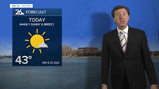
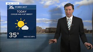
Today is actually going to be a pretty nice day with highs in the low/mid-30s without much wind. There is a chance of a little wintry mix or light snow overnight tonight with lows in the mid-20s. The weekend storm will come in two main waves. The first wave is weak and will be here mainly Saturday morning. This will bring a wintry mix of some snow or freezing rain. Any accumulating snow will only be 1" or less, but any light freezing rain in the morning could make things a little icy. Give it times as temps will pop up above freezing Saturday into the upper-30s. The second, strong wave gets here on Saturday night. There is still some uncertainty with the exact track of this storm, so stay tuned to the latest forecast. For Green Bay and the Fox Cities, this should start out as mainly rain. The farther you live to the north and northwest, the better the chance that this is going to stay as all snow and it could be heavy. Either way you cut it, as the night wears on, even in the Fox Cities, this will probably start changing over to snow overnight, while it keeps snowing to the north and northwest. The winds will be picking up as well with overnight lows dropping to near 30. The snow and VERY strong wind will continue on Sunday before gradually tapering off. Right now, there's the potential of only 1-3" of snow accumulation for Green Bay and the Fox Cities, but to the north and northwest, 6-12" may fall. If this system moves a little bit as it gets here, that's going to have a big impact on snow totals. Highs Sunday will be in the mid-30s. Some of the wind gusts could be 40-45 MPH. Monday will be very cold and blustery with highs in the low-teens. This February will be one of the snowiest on record when all is said & done with the potential for more snow next week on Tuesday night. The month looks to end on a very cold note with temps will be running 15-25° below normal as we head into March.
-
 3:36
3:36
WGBA
10 months agoWill it be necessary to have both the AC & the heat on during the same day??
1931 -
 2:33
2:33
WGBA
3 years agoMichael Fish's NBC 26 weather forecast
4 -
 2:19
2:19
WGBA
3 years agoMichael Fish's NBC 26 weather forecast
3 -
 2:26
2:26
WGBA
3 years agoMichael Fish's NBC 26 weather forecast
4 -
 2:24
2:24
WGBA
3 years agoMichael Fish's NBC 26 weather forecast
3 -
 1:57
1:57
WGBA
3 years agoMichael Fish's NBC 26 weather forecast
2 -
 2:27
2:27
WGBA
3 years agoMichael Fish's NBC 26 weather forecast
4 -
 2:31
2:31
WGBA
3 years agoMichael Fish's NBC 26 weather forecast
7 -
 1:50
1:50
WGBA
3 years agoMichael Fish's NBC 26 weather forecast
4 -
 2:27
2:27
WGBA
3 years agoMichael Fish's NBC 26 weather forecast
1