Olathe Public Works uses system to track road conditions amidst winter weather
5 years ago
7
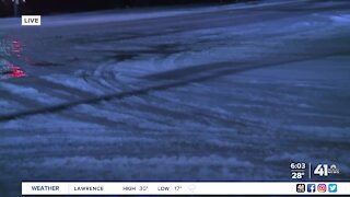
To stay ahead of the continuing winter, the City of Olathe is using a geographical information system (GIS) to track road conditions. The GIS shows where trucks have been on their routes, what’s been treated and what hasn’t yet. It’s a tool residents can also use to check conditions in their neighborhoods. That data helps system managers in a number of different ways.
Loading comments...
-
 2:17
2:17
KSHB
11 months ago'These are glory days': Lenexa family holds 55-year reign for Chiefs season tickets
292 -
 2:03
2:03
KSHB
3 years ago6 a.m. road conditions in Olathe
14 -
 2:03
2:03
KSHB
3 years ago6 a.m. road conditions in Olathe
2 -
 2:03
2:03
KSHB
3 years agoSaturday Weather Conditions Update
29 -
 2:33
2:33
WXYZ
3 years agoWinter weather ahead
178 -
 1:33
1:33
WEWS
3 years agoIs your car safe for winter weather conditions?
9 -
 1:04
1:04
WXYZ
3 years agoWinter Weather Advisory
333 -
 3:14
3:14
WXYZ
3 years agoWinter Weather Advisory
150 -
 2:21
2:21
WXYZ
3 years agoWinter Weather Advisory
298 -
 1:59
1:59
KSHB
3 years agoOlathe Public Schools mandate masks for K-12th grade
131