Michael Fish's NBC26 Storm Shield weather forecast
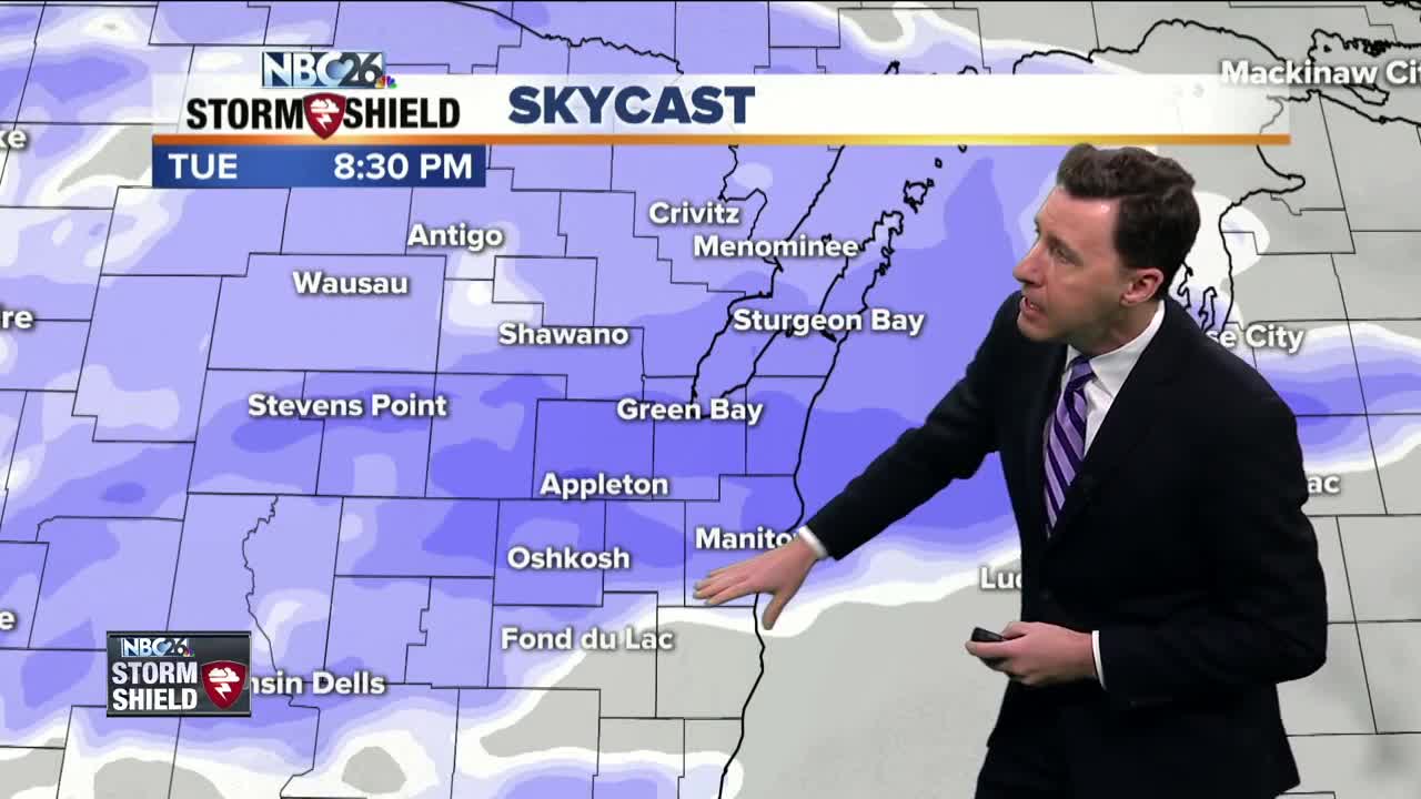
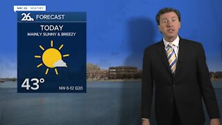
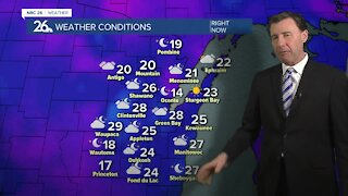
We have an active weather pattern in-store for the next several days. The first part of this activity starts as some light snow working its way from the west and works its way east through the mid- to late-afternoon. Some light accumulation is possible in parts of the area by the evening commute. This snow becomes steadier tonight, though it may start to mix with some freezing rain or drizzle the farther south you live. 1-3" of snow currently is projected with the higher amounts of 3-6" north of Green Bay. Soon after, another system moves in Thursday into Friday morning with some snow or wintry mix. Stay tuned......... Saturday will be dry but then another round of snow is possible on Sunday. Temperatures over the next 7 days are generally going to be below average but there is no MAJOR arctic blast in the foreseeable future at least.
-
 3:36
3:36
WGBA
1 year agoWill it be necessary to have both the AC & the heat on during the same day??
3781 -
 2:33
2:33
WGBA
4 years agoMichael Fish's NBC 26 weather forecast
4 -
 2:19
2:19
WGBA
4 years agoMichael Fish's NBC 26 weather forecast
3 -
 2:26
2:26
WGBA
4 years agoMichael Fish's NBC 26 weather forecast
4 -
 2:24
2:24
WGBA
4 years agoMichael Fish's NBC 26 weather forecast
3 -
 2:27
2:27
WGBA
4 years agoMichael Fish's NBC 26 weather forecast
4 -
 1:57
1:57
WGBA
4 years agoMichael Fish's NBC 26 weather forecast
2 -
 2:31
2:31
WGBA
4 years agoMichael Fish's NBC 26 weather forecast
7 -
 1:50
1:50
WGBA
4 years agoMichael Fish's NBC 26 weather forecast
4 -
 2:27
2:27
WGBA
4 years agoMichael Fish's NBC 26 weather forecast
1