NBC26 Storm Shield weather forecast
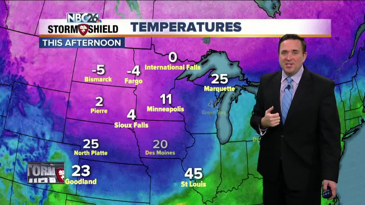
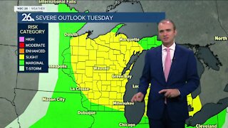
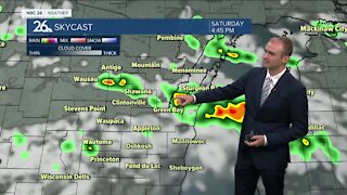
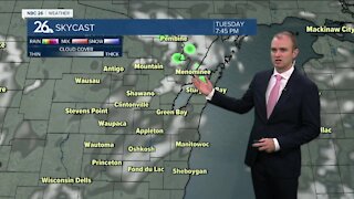
After fog, rain & warm temps.......our taste of spring is over!! Much colder air will pour inthe area overnight behind a strong cold front that is now pushing to the east. Overnight lows will be in the single digits with wind chills near zero. Highs on Tuesday will only be in the upper teens....20-30° colder than Monday. The next chance of snow or wintry mix moves in late Tuesday into Tuesday night. 1-3" of snow currently is projected with the higher amounts of 3-6" north of Green Bay. Soon after, another system moves in Thursday into Friday morning with some snow or wintry mix. Stay tuned......... Saturday will be dry but then another round of snow is possible on Sunday. Temperatures over the next 7 days are generally going to be below average but there is no MAJOR arctic blast in the foreseeable future at least.
-
 1:45
1:45
WGBA
1 year agoFond du Lac Cardinals start the football season with a new $5.3 million nest
385 -
 4:13
4:13
WGBA
4 years agoGino Recchia NBC26 Weather Forecast
31 -
 4:13
4:13
WGBA
4 years agoGino Recchia NBC26 Weather Forecast
41 -
 3:36
3:36
WGBA
4 years agoGino Recchia NBC26 Weather Forecast
10 -
 3:29
3:29
WGBA
4 years agoGino Recchia NBC26 Weather Forecast
12 -
 4:09
4:09
WGBA
4 years agoGino Recchia NBC26 Weather Forecast
11 -
 3:28
3:28
WGBA
4 years agoGino Recchia NBC26 Weather Forecast
11 -
 3:46
3:46
WGBA
4 years agoGino Recchia NBC26 Weather Forecast
13 -
 3:32
3:32
WGBA
4 years agoGino Recchia NBC26 Weather Forecast
17 -
 2:33
2:33
WGBA
4 years agoGino Recchia NBC26 Weather Forecast
15