NBC26 Storm Shield weather forecast
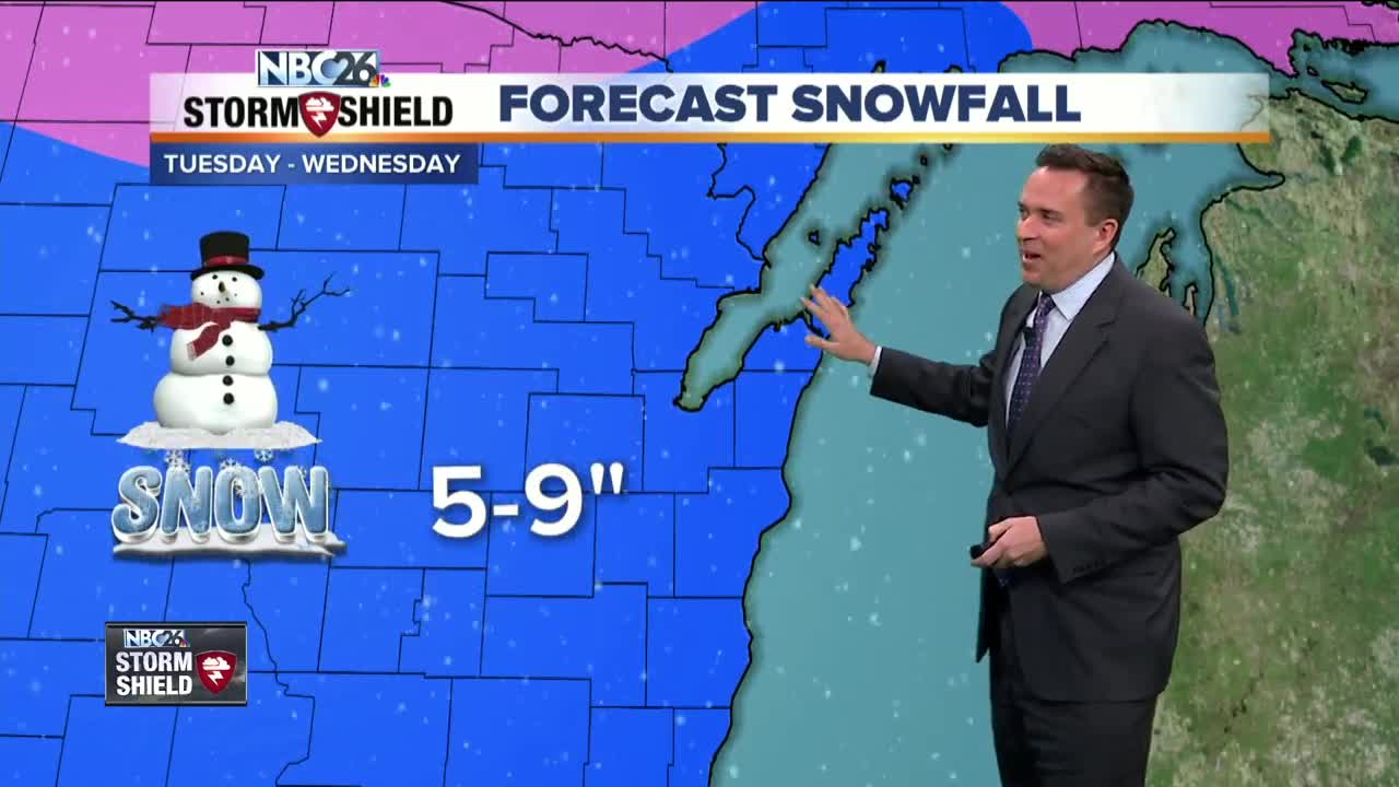
The biggest snowstorm of the winter arrives Tuesday. Winter storm watches have been issued for Marquette, Green Lake, Fond Du Lac, and Sheboygan Counties.....with a Winter Advisory farther north. You will be needing the shovels and the snow blowers perhaps by Tuesday evening. Right now it appears that a band of snow will quickly sweep through early Tuesday morning north of Highway 29, then a lull until lunch hour followed by widespread snowfall overspreads the entire area from the southwest. This will continue into Wednesday morning and should make an exit out of the area by lunchtime. Snowfall totals at this time will range from 5 to 9 inches area-wide with some locally higher totally between 9 to 11 inches possible. A weak clipper on Thursday may bring a light dusting of snowfall following by some very chilly air on Friday with highs possibly staying below zero for many spots. the weekend doesn't look too much better, afternoon highs will stay in the negative single digits. Record low temps are possible Saturday morning if we have clear skies & light winds. More snow arrives on Monday.
-
 1:45
1:45
WGBA
1 year agoStudents excited to start at "huge and beautiful" Vel Phillips Middle School
387 -
 3:36
3:36
WGBA
4 years agoGino Recchia NBC26 Weather Forecast
10 -
 4:09
4:09
WGBA
4 years agoGino Recchia NBC26 Weather Forecast
11 -
 3:46
3:46
WGBA
4 years agoGino Recchia NBC26 Weather Forecast
13 -
 3:32
3:32
WGBA
4 years agoGino Recchia NBC26 Weather Forecast
17 -
 2:33
2:33
WGBA
4 years agoGino Recchia NBC26 Weather Forecast
15 -
 4:18
4:18
WGBA
4 years agoGino Recchia NBC26 Weather Forecast
11 -
 3:08
3:08
WGBA
4 years agoGino Recchia NBC26 Weather Forecast
17 -
 3:24
3:24
WGBA
4 years agoGino Recchia NBC26 Weather Forecast
18 -
 1:55
1:55
WGBA
4 years agoGino Recchia NBC26 Weather Forecast
9