Gino Recchia NBC26 Storm Shield Weather Forecast
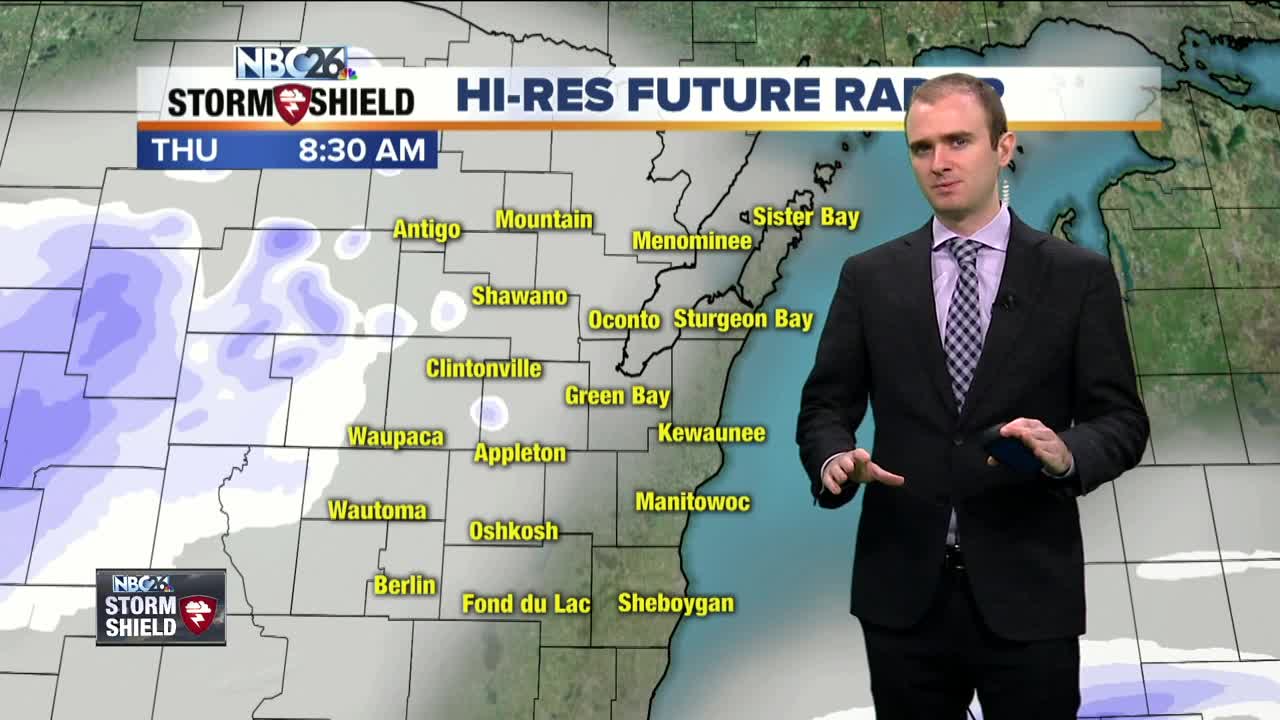
It was a nice break from the cloudy weather yesterday but the clouds are right back with us today. There is a low pressure that is moving from the Southern Plains towards the Ohio River Valley. Accumulating snowfall will occur with this storm, but not in our area. The only exception where we could see a light dusting of snowfall will be from the potential of light lake effect snow showers. Winds will be initially coming in from the southeast pushing a light band of snow from the lake towards our lakeside counties. A dusting to a half inch could accumulate if the snow bands stick around for a little bit. The rest of the area will see either flurries or nothing at all. Temperatures warm up into the upper 20s and then once the storm moves out of the area later in the evening, winds will shift to the west and draw in some colder air. Overnight, we will drop into the lower teens and single digits, winds will be out of the northwest at 5 to 10 mph with partly cloudy skies. High temperatures Friday will rise up into the upper teens to near 20 degrees under partly cloudy skies and winds coming in from the north and northeast around 5 to 10 mph. There is another storm system that is going to move in this weekend and there still remains some questions regarding how far north this storm will affect parts of Wisconsin. Some of the data is keeping this storm well to the south of us, while some others are showing the potential of a few inches over our area, mainly along and south of Highway 29. If it does snow, it would be on Saturday. Temperatures will also be chilly, highs in the mid teens making this a light and fluffy snow. Whatever the case will be, behind this storm, the coldest air of the season will be here on Sunday, temperatures may not get out of the single digits.
-
 1:45
1:45
WGBA
1 year agoFond du Lac Cardinals start the football season with a new $5.3 million nest
387 -
 2:33
2:33
WGBA
4 years agoGino Recchia NBC26 Weather Forecast
15 -
 3:46
3:46
WGBA
4 years agoGino Recchia NBC26 Weather Forecast
13 -
 3:32
3:32
WGBA
4 years agoGino Recchia NBC26 Weather Forecast
17 -
 3:08
3:08
WGBA
4 years agoGino Recchia NBC26 Weather Forecast
17 -
 3:24
3:24
WGBA
4 years agoGino Recchia NBC26 Weather Forecast
18 -
 1:55
1:55
WGBA
4 years agoGino Recchia NBC26 Weather Forecast
9 -
 4:18
4:18
WGBA
4 years agoGino Recchia NBC26 Weather Forecast
11 -
 2:53
2:53
WGBA
4 years agoGino Recchia NBC26 Weather Forecast
13 -
 3:59
3:59
WGBA
4 years agoGino Recchia NBC26 Weather Forecast
14