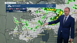
Gino Recchia NBC26 Storm Shield Weather Forecast
The misty and cloudy weather resulting in several instances of freezing drizzle have finally moved out of the area but so has the above average temperatures. Winds have shifted out from the north behind a cold front last night and that is going to keep our high temperatures today a little below average, lower 20s with wind speeds around 5 mph. Tonight skies will remain mostly clear with overnight lows in the lower to mid teens and winds out of the southeast around 2 to 5 mph. Thursday we will begin with sunshine but as the day goes on, skies will increase in cloud cover. There may be a few flurries or a passing snow shower during the afternoon and evening. A cold front will push through and behind it, some chilly weather is going to arrive for the weekend. High temperatures on Thursday will be in the upper 20s. Fridays highs will be in the lower 20s with partly cloudy skies. This weekend, there is a storm system that requires some monitoring, mostly on Saturday. A strong low pressure will develop across the Southern Plains before heading northeastward. Based on the track of this storm, some areas especially to our southern sections of the NBC26 viewing area may wind up with several inches of snowfall. Behind this storm system, temperatures remain in the lower teens for Sunday and mid teens on Monday.
-
 3:36
3:36
WGBA
7 months agoWill it be necessary to have both the AC & the heat on during the same day??
971 -
 2:33
2:33
WGBA
2 years agoGino Recchia NBC26 Weather Forecast
15 -
 3:46
3:46
WGBA
2 years agoGino Recchia NBC26 Weather Forecast
13 -
 3:32
3:32
WGBA
2 years agoGino Recchia NBC26 Weather Forecast
17 -
 3:08
3:08
WGBA
2 years agoGino Recchia NBC26 Weather Forecast
17 -
 3:24
3:24
WGBA
2 years agoGino Recchia NBC26 Weather Forecast
14 -
 1:55
1:55
WGBA
2 years agoGino Recchia NBC26 Weather Forecast
9 -
 4:18
4:18
WGBA
2 years agoGino Recchia NBC26 Weather Forecast
11 -
 2:53
2:53
WGBA
2 years agoGino Recchia NBC26 Weather Forecast
13 -
 3:59
3:59
WGBA
2 years agoGino Recchia NBC26 Weather Forecast
13