Michael Fish's NBC26 Storm Shield weather forecast
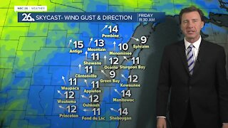
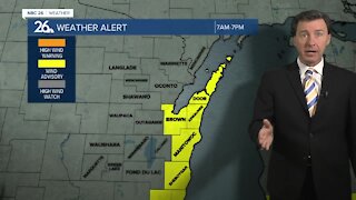
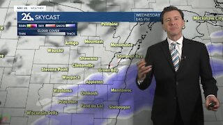
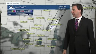
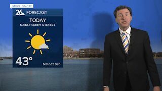
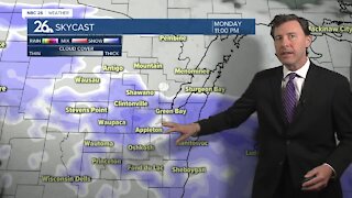
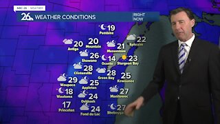
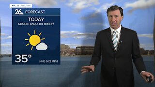
Today, skies will become mostly cloudy with a breeze out of the southwest around 5 to 10 mph with temperatures climbing into the low- to mid-30s. With a weak disturbance on the way, we might see a very light wintry mix in the late afternoon, but most of the day should be fine. Tonight, that weak disturbance will be moving through, and as it does, it might bring a little, light wintry mix. Lows will be around 20. Tuesday will be nearly identical to Monday with highs back in the mid-30s with partly to mostly cloudy skies. Wednesday will be a little cooler with highs in the mid-20s under mostly sunny skies. There is a weak system that is going to move across the area Thursday evening. A few flurries or passing snow showers are possible. Highs will be in the upper 20s. The coldest air of the season arrives behind this arctic front going into the weekend. It appears that temperatures will remain well below normal going into the second half of January. Up until today, we are the 8th warmest start to winter on record. With this cold air however moving in, that will definitely change. For anyone hoping for a snow storm in our area, you might want to try somewhere else for the next 7 days.
-
 3:36
3:36
WGBA
7 months agoWill it be necessary to have both the AC & the heat on during the same day??
971 -
 2:33
2:33
WGBA
3 years agoMichael Fish's NBC 26 weather forecast
4 -
 2:19
2:19
WGBA
3 years agoMichael Fish's NBC 26 weather forecast
3 -
 2:26
2:26
WGBA
3 years agoMichael Fish's NBC 26 weather forecast
4 -
 2:24
2:24
WGBA
3 years agoMichael Fish's NBC 26 weather forecast
3 -
 2:27
2:27
WGBA
3 years agoMichael Fish's NBC 26 weather forecast
4 -
 1:57
1:57
WGBA
3 years agoMichael Fish's NBC 26 weather forecast
2 -
 2:31
2:31
WGBA
3 years agoMichael Fish's NBC 26 weather forecast
7 -
 1:50
1:50
WGBA
3 years agoMichael Fish's NBC 26 weather forecast
4 -
 2:27
2:27
WGBA
3 years agoMichael Fish's NBC 26 weather forecast
1