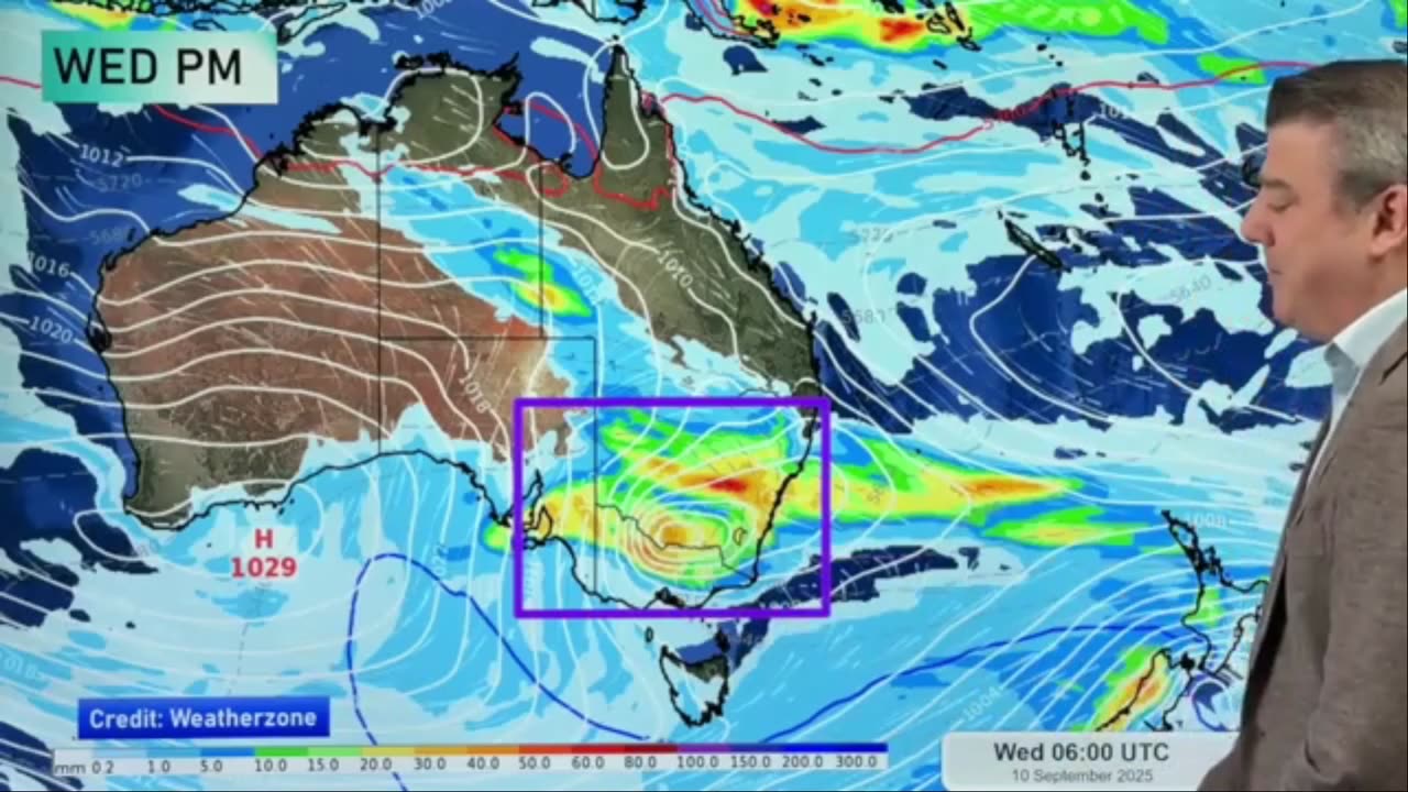
Oz: NSW & Vic most in the firing line for t-storms/rain
A line of thunderstorms stretches off and on from the Top End down to NSW. In the days ahead a low (currently near southern WA) will move in to Vic/NSW and the A.C.T - and produces more rain, showers and thunderstorms. Rainfall totals vary locally.
There are showers in other parts of Australia, but not as widespread.
More polar air is briefly coming into parts of SA and Tas, while warmer air drops further southwards into Qld and NSW for a time too.
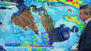
After this all? High pressure again in the south.
We have Australia's forecast out to Sunday.
*Please note, we have internet disruption to our studio this week, this may result in videos temporarily being lower quality (SD and not HD) due to slow upload times to YouTube. (Video quality today is 720p and not 4K).
-
 12:07
12:07
WeatherWatch
6 days agoOz: Stormy stuff on the way as spring wakes up
1.01K1 -
 2:42:09
TimcastIRL
6 hours agoNATO Scramble Air Force Over Russian Incursion Into Poland, HIGH ALERT Reported | Timcast IRL
169K94 -
 25:46
25:46
Man in America
10 hours agoALERT: Gold Prices FLASH OMINOUS WARNING for the Dollar—Are You READY??
28.8K17 -
 58:27
58:27
Sarah Westall
6 hours agoWar Exploding Around the World: Nepal, Israel, Qatar, Venezuela, Thailand, more... w/ Michael Yon
35.9K12 -
 LIVE
LIVE
SpartakusLIVE
8 hours agoThe Most INSANE Snipes EVER || Solo to Duos w/ StevieT - PUBG or Mordor Later?!
418 watching -
 1:11:40
Flyover Conservatives
16 hours agoThe Truth About Israel & End Times Nobody Wants to Say - Phil Hotsenpiller | FOC Show
35.3K11 -
 LIVE
LIVE
GritsGG
5 hours agoSweaty Ranked Grind! Most Wins in WORLD! 3600+!
210 watching -
![[ Tekken Tuesday ] TNS Tekken Tournament Watch Party](https://1a-1791.com/video/fww1/5b/s8/1/4/a/C/g/4aCgz.0kob-small--Tekken-Tuesday-TNS-Watch-P.jpg) 4:04:31
4:04:31
CHiLi XDD
5 hours ago[ Tekken Tuesday ] TNS Tekken Tournament Watch Party
21.5K4 -
 1:53:04
Glenn Greenwald
8 hours agoIsrael Bombs Qatar and Trump Reacts; The Hoax to Blame Russia for Jamming EU President's Plane GPS; Mamdani Soars in Polls as he Tries to Moderate on Israel | SYSTEM UPDATE #511
102K66 -
 2:47:57
Barry Cunningham
8 hours agoLIVE: PRESIDENT TRUMP ANNOUNCEMENT | IRYNA ZARUTSKA DESERVES IMMEDIATE JUSTICE! NO WAITING!
61.9K61