Premium Only Content

Garmin GPS> Using the Military Grid System
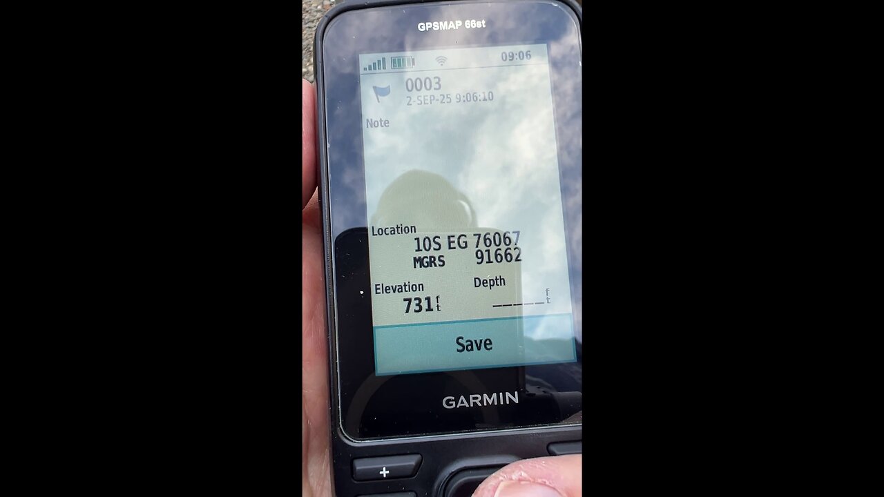
This video shows you how to configure your Garmin GPS to use the Military Grid System and enter a Waypoint to navigate to.
The Military Grid Reference System (MGRS) is a geocoordinate standard used by the military for locating points on Earth. It’s based on the Universal Transverse Mercator (UTM) projection and provides a precise, grid-based method for identifying locations. Here’s a concise breakdown:
• Structure: An MGRS coordinate consists of:
○ Grid Zone Designator (GZD): A number (1–60) for the UTM zone and a letter (C–X) for the latitude band (e.g., "38S" for UTM zone 38, southern hemisphere).
○ 100,000-meter Square Identifier: Two letters (e.g., "LC") identifying a 100 km × 100 km square within the grid zone.
○ Easting and Northing: Numeric values (in meters) pinpointing a location within the 100,000-meter square. These can vary in precision (e.g., 1 m, 10 m, 100 m), typically given as 5 digits each for 1-meter accuracy (e.g., "12345 67890").
• Example: An MGRS coordinate like 38SLC1234567890 indicates:
○ 38S: UTM zone 38, southern hemisphere.
○ LC: A specific 100,000-meter square.
○ 12345: Easting (x-coordinate, 12.345 km east of the square’s origin).
○ 67890: Northing (y-coordinate, 67.890 km north of the square’s origin).
• Purpose: MGRS is designed for simplicity and precision, especially for ground operations, allowing quick plotting on maps and interoperability with GPS devices like the Garmin GPSMAP 66st. It’s widely used by NATO and other military forces.
Garmin GPS devices support many different coordinate formats.
Link to my Etsy Store:
https://betacygnidesigns.etsy.com/
-
 25:09
25:09
Helping others to learn new things and experience other parts of the world.
5 days ago3d Printing & Assembly of a Complex Model: SpaceX Starship, Super Heavy, and Launch Tower - Part 18
-
 13:07
13:07
Silver Dragons
20 hours agoBullion Dealer Reacts to SILVER PRICE SURGING!
1.54K5 -
 1:06:28
Timcast
3 hours agoTrump Admin Threatens GOP Who Vote To Release Epstein Files
129K92 -
 2:13:09
Side Scrollers Podcast
4 hours agoDruski/White Face Controversy + Women “Experience Guilt” Gaming + More | Side Scrollers Live
22.5K3 -
 1:39:53
The Mel K Show
3 hours agoMORNINGS WITH MEL K - Narratives Implode as Light Shines on Covid Deception 9-3-25
17.6K7 -
 DVR
DVR
The Shannon Joy Show
2 hours agoExclusive With Congressman Tom Massie: "The Epstein Files Are NOT A Hoax. There Are Real Victims"
12.1K2 -
 1:52:46
Steven Crowder
5 hours agoCongress Drops New Epstein Files and Trump Drops New Bombs on Venezuela Terrorists
307K178 -
 1:10:39
The Rubin Report
4 hours agoCNN Host Actually Thought She'd Outsmarted Shapiro, Until He Asked This
66K47 -
 1:02:00
VINCE
6 hours agoThe Left's Demented Fantasies Shatter | Episode 117 - 09/03/25
215K131 -
 59:34
59:34
Nikko Ortiz
4 hours agoPainful Military Fails
39.5K1