LIGHTNING STORMS + HEAT WAVE & COOL DOWN
Dangerous #Heat in the West; Coastal Flooding & High Rip Current Risk into the Weekend on the East Coast; Flash Flooding Possible in the Southeast #weather #meteorology #forecast
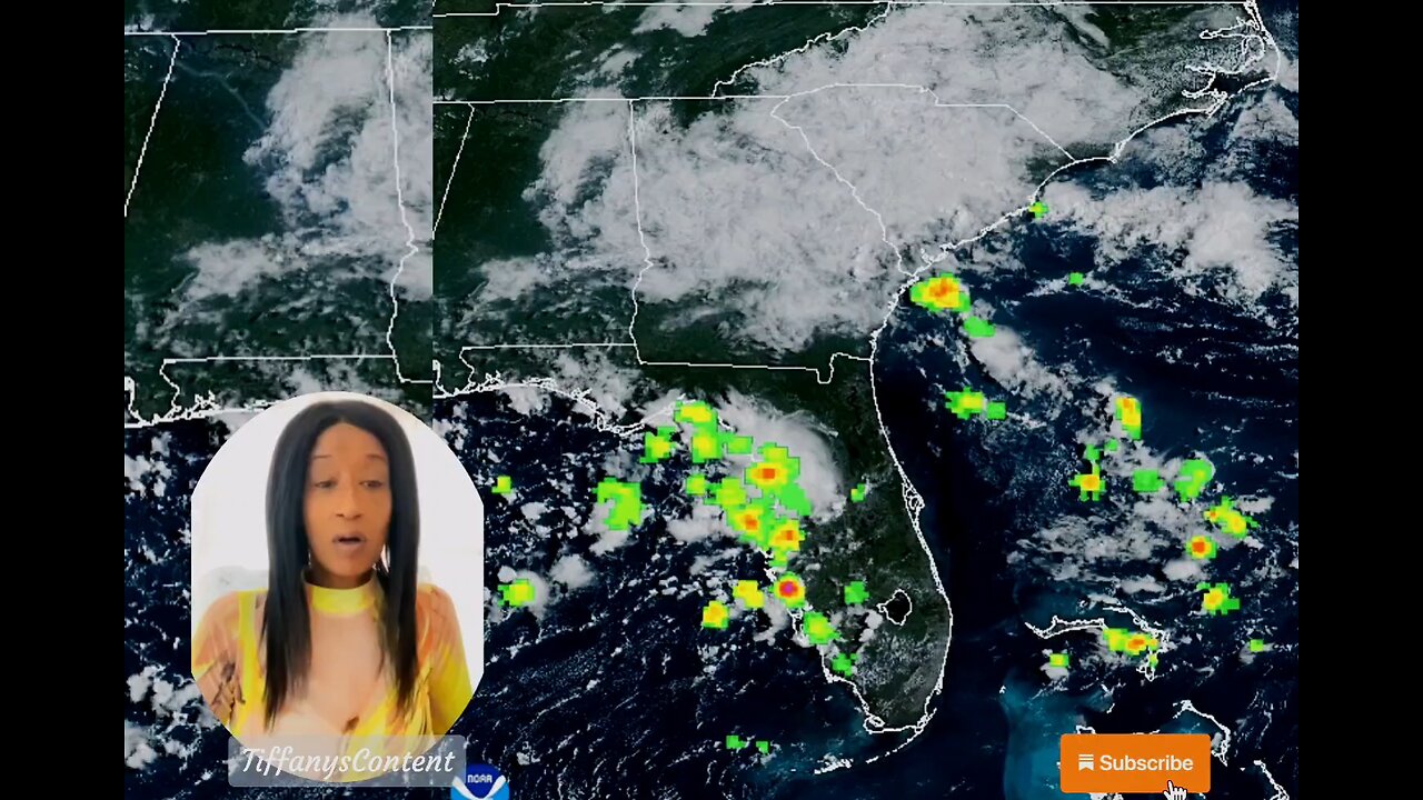
A dangerous, record heat wave continues for the Desert Southwest and the Central Valley of California through Saturday, and the Pacific Northwest through Tuesday. Coastal flooding is expected through tonight at high tide along the Eastern Seaboard from Erin, while the high rip current risk and dangerous surf continue through the weekend. Flash flooding possible today in Georgia and South Carolina. Read More >Active Systems:
The National Hurricane Center is issuing advisories on Hurricane
Erin, located over the northwestern Atlantic Ocean.
1. Near the Leeward Islands (AL90):
Showers and thunderstorms are showing some signs of organization in
association with a tropical wave located about a hundred miles
east-northeast of the northern Leeward Islands. Environmental #news
conditions appear conducive for further development of this system,
and a tropical depression or tropical storm is very likely to form
this weekend while it moves northwestward and then northward, in
between the northern Leeward Islands and Bermuda.
* Formation chance through 48 hours...high...80 percent.
* Formation chance through 7 days...high...90 percent. #tropicalstorm
2. Central Tropical Atlantic (AL99):
Showers and thunderstorms associated with a tropical wave located
about midway between Africa and the Windward Islands have become
less organized overnight. While there is still some chance that a
short-lived tropical depression could form during the next day or
so, the system is expected to move through a less conducive
environment into Saturday. The wave could reach a slightly more
favorable environment again late this weekend into early next week
as it moves westward at 10 to 15 mph over the central tropical
Atlantic and approaches the Lesser Antilles.
* Formation chance through 48 hours...medium...40 percent.
* Formation chance through 7 days...medium...50 percent.
3. Central Subtropical Atlantic:
A small area of low pressure located well southwest of the Azores
has weakened overnight, and no development is expected while it
drifts northward.
* Formation chance through 48 hours...low...near 0 percent.
* Formation chance through 7 days...low...near 0 percent.
Forecaster Blake nhc
other sources
nhc
tropical tidbits
star nesdis noaa gov
weather gov
spaghettimodels
-
 2:04:38
Side Scrollers Podcast
17 hours agoEveryone HATES Baseball Karen + Gaming’s Newest Virtue Signal + MORE | Side Scrollers Live
27.3K7 -
 1:13:08
The HotSeat
14 hours agoWhen Local Authorities Won’t Act, the Feds Will
8.02K16 -
 15:13
15:13
The Pascal Show
9 hours ago $0.56 earnedHE LIED?! Trump In Hot Water After Lewd Epstein Birthday Card Released By Oversight Committee
6.72K13 -
 LIVE
LIVE
Lofi Girl
2 years agoSynthwave Radio 🌌 - beats to chill/game to
188 watching -
 14:47
14:47
GritsGG
8 days agoRumble Tournament Dubular! Rebirth Island Custom Tournament!
110K6 -
 2:03:11
Inverted World Live
10 hours agoY2K 2.0 | Ep. 104
132K9 -
 2:02:53
Badlands Media
14 hours agoBaseless Conspiracies Ep. 149: Epstein Docs, Charlotte Stabbing, and Trump’s Next Moves
52.7K19 -
 2:56:12
TimcastIRL
9 hours agoTrump SLAMS Democrats Over Irina Zarutska Killing, Says WAR Over Chicago Crime | Timcast IRL
199K124 -
 29:08
29:08
Afshin Rattansi's Going Underground
1 day agoCol. Lawrence Wilkerson: World War 3 is ALREADY HERE, Netanyahu is INTENT on Greater Israel
27.3K26 -
 7:24:49
SpartakusLIVE
11 hours agoNONSTOP Snipes, Rockets, and BICEPS = Monday MOTIVATION
79.6K1