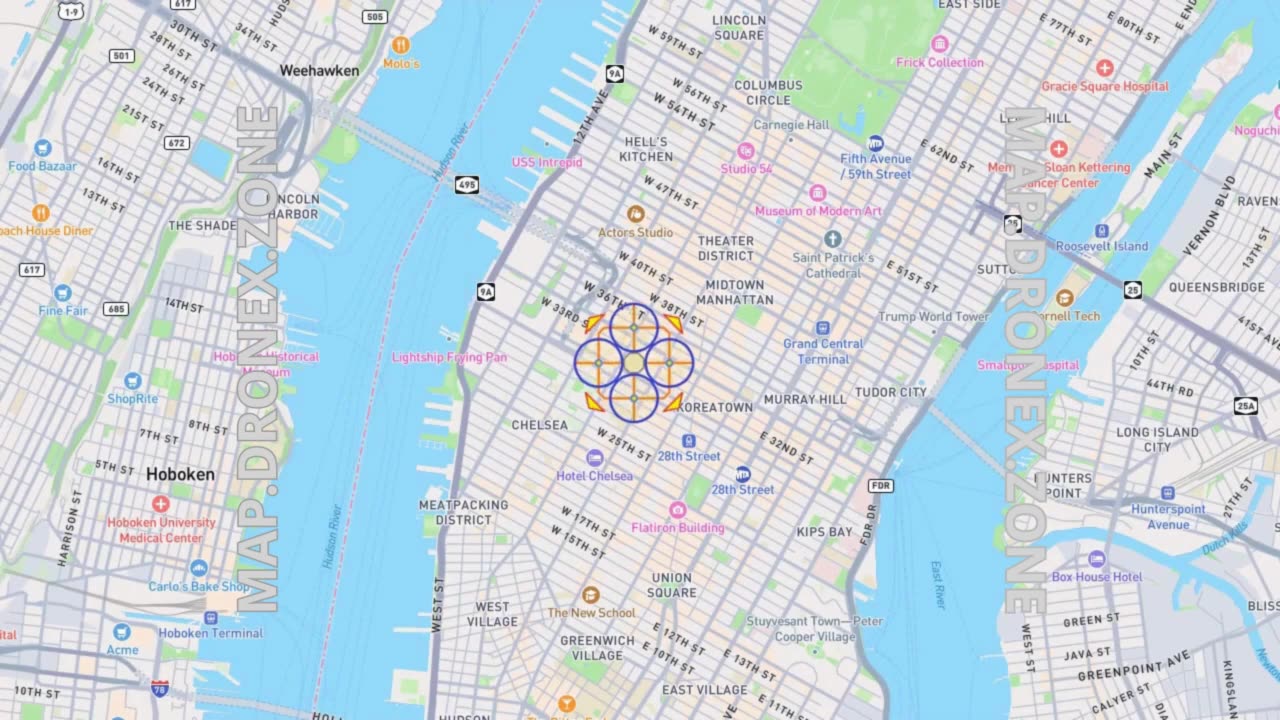
Define X Drone Fly Zone on Map by Airports Locator Tool
15 days ago
211
Define X Drone Fly Zone on Map by Airports Locator Tool
Ensure safe and compliant drone flights with this step-by-step guide on using an airports locator tool to map restricted airspace. Whether you’re a hobbyist or a professional pilot, understanding no-fly zones is critical for avoiding fines and keeping operations legal.
Key Takeaways:
✔️ How to identify FAA (or local) no-fly zones near airports
✔️ Tools to visualize restricted airspace
✔️ Best practices for pre-flight planning
Ideal for: Drone pilots, aerial photographers, surveyors, and commercial operators.
Tools Mentioned: >> MAP.DRONEX.ZONE <<
#DroneMapping #AirspaceSafety #NoFlyZone #DronePilot #AerialData #UAV #DroneTech #FlightPlanning
Loading comments...
-
 2:54:09
Badlands Media
11 hours agoDEFCON ZERQ Ep. 007
34.1K32 -
FreshandFit
2 hours agoOwen Shroyer leaves Alex Jones But Here's the Truth!
9.86K4 -
 2:04:10
Inverted World Live
8 hours agoJapanese Memory Eraser | Ep. 101
88.7K17 -
 2:42:52
TimcastIRL
5 hours agoTrump To Deploy National Guard To Chicago, Baltimore, Democrats Call To Resist | Timcast IRL
210K57 -
 3:22:30
Laura Loomer
7 hours agoEP141: Muslims Call For Political Assassinations At Michigan Palestinian Conference
40.1K24 -
 4:39:32
Barry Cunningham
7 hours agoBREAKING NEWS: PRESIDENT TRUMP IS GOING TO TAKE CHICAGO! LFG!!! (IT'S MOVIE NIGHT!)
85.5K58 -
 1:23:59
Man in America
9 hours agoTrump Demands Big Pharma Come Clean on Covid Shots w/ Dr. David Martin
43.5K28 -
 1:40:27
megimu32
5 hours agoOTS: Labor Day Sitcom Blowout - Tim, Ray, & Relatable Chaos!
36.6K5 -
 4:09:30
StevieTLIVE
5 hours agoWarzone Wins w/ FL Mullet Man
32.1K1 -
 1:04:01
BonginoReport
8 hours agoLefties Wish Death on Trump but He’s BACK! - Nightly Scroll w/ Hayley Caronia (Ep.125)
189K83