WEATHER NEWS, REACTIONS, SHARING UPDATES!
Extreme #Heat in the Central US Expands to the East; Heavy #Rain from the Southern Plains to the #GreatLakes
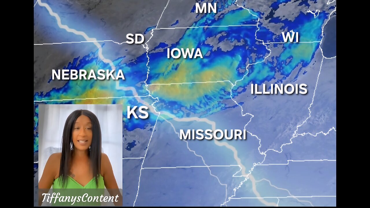
Dangerous, long-lasting heat remains across the Mid-South to Mid- #Mississippi Valley, while heat expands into the #Northeast for a brief period on Friday. Strong to isolated #severethunderstorms and heavy rain pose a #flashflooding threat from from the southern High Plains east to the Great Lakes. Tropical Depression 12W brings heavy rain to Guam & the Marianas through Saturday
North #Atlantic... #Caribbean Sea and the #GulfofAmerica
1. North-Central Gulf:
A trough of low pressure over the north-central Gulf is currently
producing a broad area of disorganized showers and #thunderstorms
Over the next day or two, this system is forecast to move generally
westward across the north-central portion of the Gulf where some
slow development is possible. By this weekend, the system is likely
to move inland, ending its chances for development. Regardless of
tropical cyclone formation, locally heavy rainfall is possible for
portions of the northern Gulf coast through this weekend.
* Formation chance through 48 hours...low...10 percent.
* Formation chance through 7 days...low...10 percent.
North Pacific...between 140W and 180W:
1. Well Southeast of the Hawaiian Islands:
An area of low pressure is forecast to develop well to the southeast
of the #HawaiianIslands by this weekend. Thereafter, some gradual
development is possible and a tropical depression could form while
the system moves generally westward at 10 to 15 mph.
* Formation chance through 48 hours...low...near 0 percent.
* Formation chance through 7 days...medium..40 percent.
spc.noaa.gov
weather.gov
nhc.noaa.gov
spaghettimodels.com
nws
-
 LIVE
LIVE
The Quartering
41 minutes agoTrump UNLOADS, Walmart Black Friday Madness & Trans Taco Bell Attack
947 watching -
 LIVE
LIVE
Side Scrollers Podcast
3 hours agoTwitch CONTROVERSY Hit New Low + Reddit Mods QUIT + FireMAN is Now Sexist + More | Side Scrollers
2,123 watching -
 10:18
10:18
Colion Noir
1 hour agoViral TikTok Proves Gun Owners Wrong?
3.42K6 -
 5:31
5:31
John Rich Official
12 days agoThe Righteous Hunter by John Rich
10.4K5 -
 LIVE
LIVE
Rebel News
1 hour agoEby threatens to block pipeline, Guilbeault out of cabinet, Land disputes continue | Rebel Roundup
368 watching -
 1:45:59
Robert Gouveia
3 hours agoAmerican Soldier DEAD! Trump Furious! Afghan 'Vetted by CIA'! Third World FREEZE!
33.3K19 -
 48:48
48:48
The Culture War with Tim Pool
2 hours agoThe West Is COLLAPSING Under Mass Migration | The Culture War's Across The Pond
18.4K39 -
 LIVE
LIVE
The Mel K Show
2 hours agoMORNINGS WITH MEL K - We Have Not Yet Begun to Fight - The Clock is Ticking! 11-28-25
1,018 watching -

Film Threat
14 hours agoHOLLYWOOD FOR SALE! BLACK FRIDAY BLOW OUT! | Film Threat Livecast
9.24K1 -
 LIVE
LIVE
The Shannon Joy Show
3 hours agoSJ Show Nov 28 - The SJ Friday Matinee Watch Party With Commentary Featuring The Big Short!
30 watching