HEATWAVE +Flash Flood +Heavy Rain & +Severe Weather +Tornadoes possible & Tropical Disturbance 1!
#Heat Wave Across the Central and Southeast US; #FlashFlood Threats in the North-Central US, #Southeast and #Guam #louisiana #florida #georgia
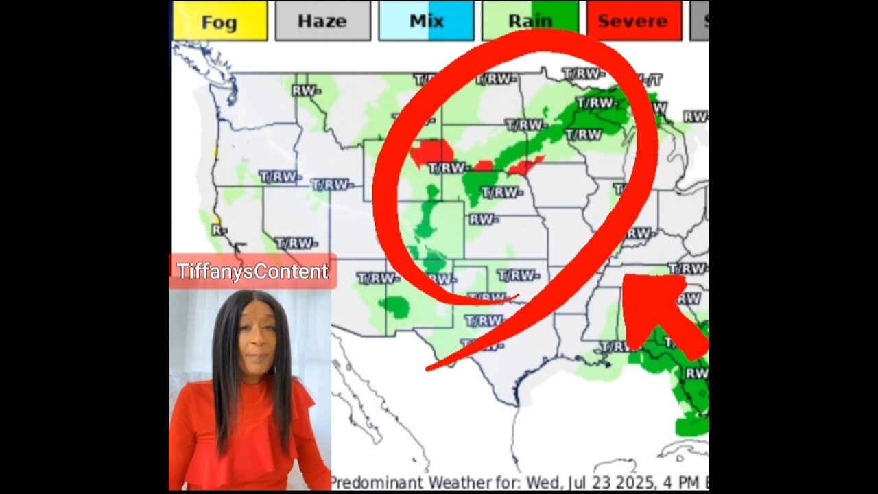
Dangerous heat is expected across portions of the Central and Southeast U.S. through July. Heavy rains, flash #flooding & #severeweather are possible across the middle #Missouri River Valley and Upper #Midwest #Milwaukee #w
#Wisconsin to the upper Great Lakes. Heavy rains and flash flooding are also possible across portions of the Southeast. A tropical disturbance brings heavy #rain to Guam & the Marianas through SaturdayNorth-Central #GulfofAmerica #tropicalstorm #thunderstorms #weather #forecast #weatherupdate #hot #heatwave
A trough of low pressure near the southeastern U.S. coast is
producing disorganized showers and thunderstorms. Over the next day
or two, this system is forecast to move west-southwestward into the
north-central portion of the Gulf where some slow development is
possible. By this weekend, the system is likely to move inland,
ending its chances for development. Regardless of tropical cyclone
formation, locally heavy #rainfall is possible for portions of
Florida over the next day or so, and for the northern Gulf coast
through this weekend.
* Formation chance through 48 hours...low...10 percent.
* Formation chance through 7 days...low...10 percent.Well Southeast of the Hawaiian Islands:
An area of low pressure is expected to form well southeast of the
#Hawaii an Islands this weekend. Thereafter, some gradual development
is possible as the system moves generally westward at 10 to 15 mph.
* Formation chance through 48 hours...low...near 0 percent.
* Formation chance through 7 days...low...30 percent.
-
 5:44
5:44
SpartakusLIVE
15 hours agoARC BOUNTY HUNTER #arcraiders
1.69K1 -
 15:50
15:50
MetatronCore
2 days agoMy Statement on Charlie Kirk's Shooting
1.37K5 -
 LIVE
LIVE
Lofi Girl
2 years agoSynthwave Radio 🌌 - beats to chill/game to
1,075 watching -
 3:31:12
Price of Reason
10 hours agoThanksgiving Special - Is Stranger Things 5 any good and other SURPRISES!
106K1 -
 14:14
14:14
Robbi On The Record
6 hours ago $1.31 earnedThe Identity Crisis No One Wants to Admit | Identity VS. Personality
8.92K2 -
 31:10
31:10
The Why Files
4 days agoThe First Earth Battalion: America's Strangest Military Experiment
51.2K26 -
 4:18:02
SpartakusLIVE
7 hours ago#1 Pilgrim of PAIN Gives Thanks HAPPILY as he DESTROYS Enemies and BAGS LOOT
171K7 -
 59:47
59:47
iCkEdMeL
7 hours ago $38.27 earnedBREAKING: National Guard Soldier Dies + New Video Shows Suspect Opening Fire
32.6K38 -
 1:20:38
Flyover Conservatives
1 day agoThanksgiving’s Hidden History: Islamic Pirates, Spanish Threats, and Socialism - Bill Federer | FOC Show
36.6K3 -
 25:43
25:43
Russell Brand
1 day agoThis Is Getting Out Of Hand
132K145