Gino Recchia NBC26 Storm Shield Weather Forecast
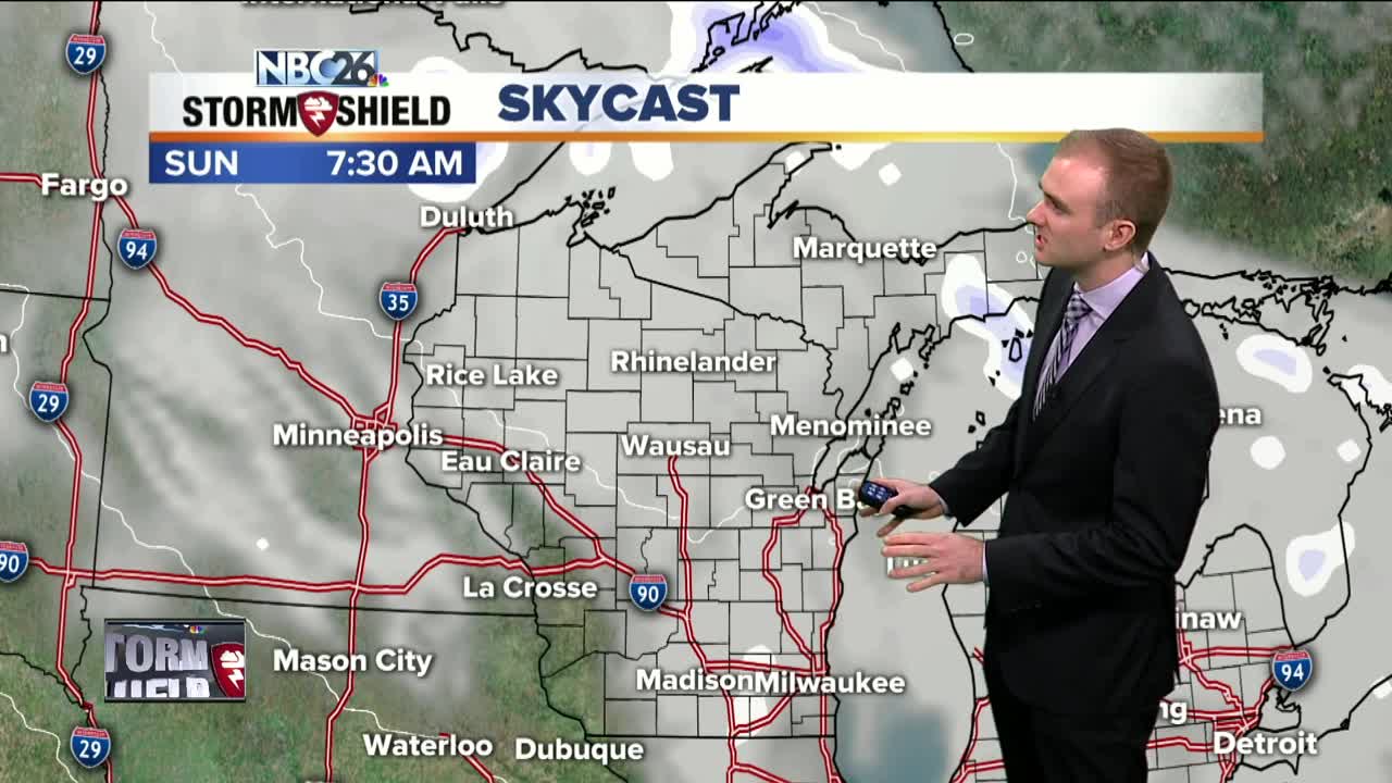
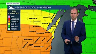
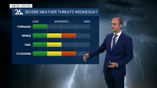
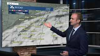
It felt more like Winter today for the first official day of it. High temperatures were in the upper 20s with cloudy skies and a few flurries around the area. Tonight expect mostly cloudy skies with temperatures falling off into the lower 20s with calm winds and a few flurries possible. Sunday, highs will be slightly warmer with temperatures in the lower 30s and light winds out of the west and southwest around 5 to 10 mph. A few flurries are also possible. Christmas Eve will have plenty of sunshine with temperatures in the lower 30s. There is the potential that some light snow would bring a dusting of snowfall to someone in the Badger State. Right now it still remains uncertain who will get under this weak wave of snowfall but I would say don't keep too high of hopes for it. Skies will increase in cloud cover ahead of our next storm system which will produce some heavy snowfall over the Central Plains and the Upper Midwest. At this time, it appears that precipitation will start off as snow behind north of the warm front but then as the front moves through, heading northwards towards the U.P., precipitation will turn over to rain during the day Thursday. Then as the storm moves out of the area Friday, and rain will turn back to snow.
-
 0:30
0:30
WGBA
1 year agoThree Degree Guarantee
362 -
 3:28
3:28
WGBA
4 years agoGino Recchia NBC26 Weather Forecast
5 -
 3:55
3:55
WGBA
4 years agoGino Recchia NBC26 Weather Forecast
1 -
 8:09
8:09
WGBA
4 years agoGino Recchia NBC26 Weather Forecast
7 -
 4:16
4:16
WGBA
4 years agoGino Recchia NBC26 Weather Forecast
1 -
 3:39
3:39
WGBA
4 years agoGino Recchia NBC26 Weather Forecast
6 -
 3:22
3:22
WGBA
4 years agoGino Recchia NBC26 Weather Forecast
9 -
 3:46
3:46
WGBA
4 years agoGino Recchia NBC26 Weather Forecast
12 -
 3:49
3:49
WGBA
4 years agoGino Recchia NBC26 Weather Forecast
2 -
 3:40
3:40
WGBA
4 years agoGino Recchia NBC26 Weather Forecast
5