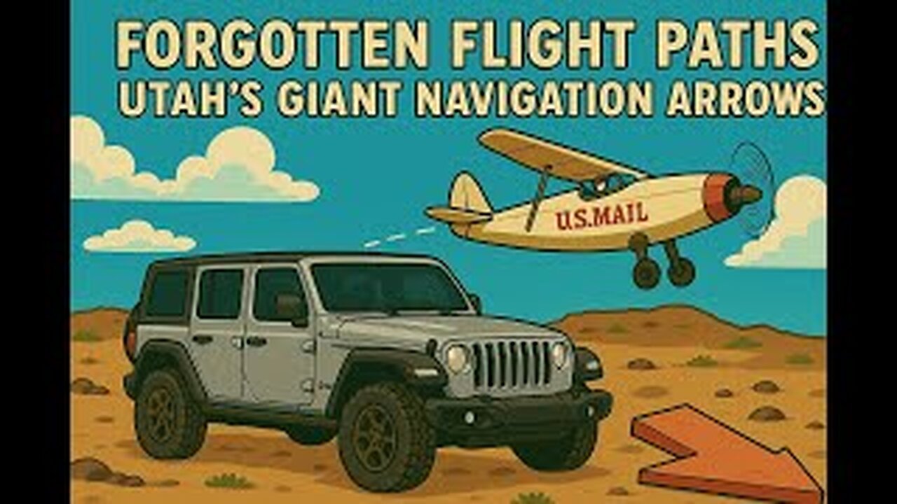
✈️ Adventure #9 | Forgotten Flight Paths | Utah’s Giant Navigation Arrows
✈️ Adventure #9 | Forgotten Flight Paths | Utah’s Giant Navigation Arrows
Welcome to Adventure #9!
In this video, we track down four giant concrete navigation arrows hidden across Southern Utah. These were part of a forgotten 1920s system used to guide airmail pilots long before GPS, radar, or modern instruments ever existed.
We followed the route northeast from St. George, hiking, driving, and exploring four surviving arrows that once pointed pilots through the desert skies.
🗺️ Terrain: A mix of mesa climbs, ridge drives, and desert roads.
📍 Stops: Bloomington Overlook, Shinob Kibe Mesa, Quail Creek Overlook, and Black Ridge.
✨ Notable: Each arrow still tells a story—some guiding straight, others signaling pilots when to turn.
🔥 Trail Info:
📍 Location: Southern Utah (St. George to New Harmony area)
🚗 Vehicle Needed: Any vehicle with decent clearance—4-wheel drive not required
🏞️ Cool Landmark: Quail Creek Arrow features a unique offset—marking a turn in the airmail route!
🤠 If you enjoy this kind of off-road history adventure:
👍 Like this video if you love exploring forgotten trails
🔔 Subscribe for more trail reviews, history, and Jeep adventures
💬 Comment below: Have you ever seen one of these arrows before?
✉️ Signature Line:
Interested in seeing a TetonX Off-Road Trailer in person?
I’m an official TetonX Ambassador based in Southern Utah.
If you're in the area and want a closer look, feel free to email me: bret@tetonx.com
🔖 Hashtags:
#ForgottenFlightPaths #SouthernUtah #Overlanding #TetonX #NavigationArrows
-
 LIVE
LIVE
Russell Brand
2 hours agoLaura Loomer: The Most Banned Woman in the World - SF632
2,767 watching -
 LIVE
LIVE
The Quartering
1 hour agoCharlie KIrk Assassin CAUGHT, Motive Revealed, Who He Was & His Confession
4,094 watching -
 LIVE
LIVE
Dr Disrespect
2 hours ago🔴LIVE - DR DISRESPECT DESTROYS BORDERLANDS 4 - INSANE LOOT, CHAOS & RAGE
1,448 watching -
 LIVE
LIVE
Sean Unpaved
1 hour agoTNF Recap: Packers Roll, Commanders Crumble & NFL/CFB's Week 2-3 Predictions
247 watching -
 2:07:09
The Culture War with Tim Pool
2 hours agoCharlie Kirk Suspect Captured, Antifa Confirmed | The Culture War with Tim Pool
104K84 -
 1:50:59
Steven Crowder
4 hours agoBREAKING: Shooter Caught & Shooting Eyewitness Joins to Discuss What He Saw
547K498 -
 LIVE
LIVE
Reidboyy
2 hours agoHow To Make $$$ in Delta Force Console Operations!
35 watching -
 LIVE
LIVE
The Mel K Show
2 hours agoMORNINGS WITH MEL K - Desperate Globalist Agenda Continues Unabated as Manufactured Chaos Abounds 9-12-25
805 watching -
 2:55:00
Benny Johnson
4 hours ago🚨Charlie Kirk's Killer CAUGHT: FBI Press Conference LIVE Right NOW | Trump Demands DEATH PENALTY
186K327 -
 DVR
DVR
Bannons War Room
6 months agoWarRoom Live
35.9M8.38K