Fata Morgana: The Phantom Islands of Maritime Folklore
https://www.ihadnoclue.com/article/1079176556436979713
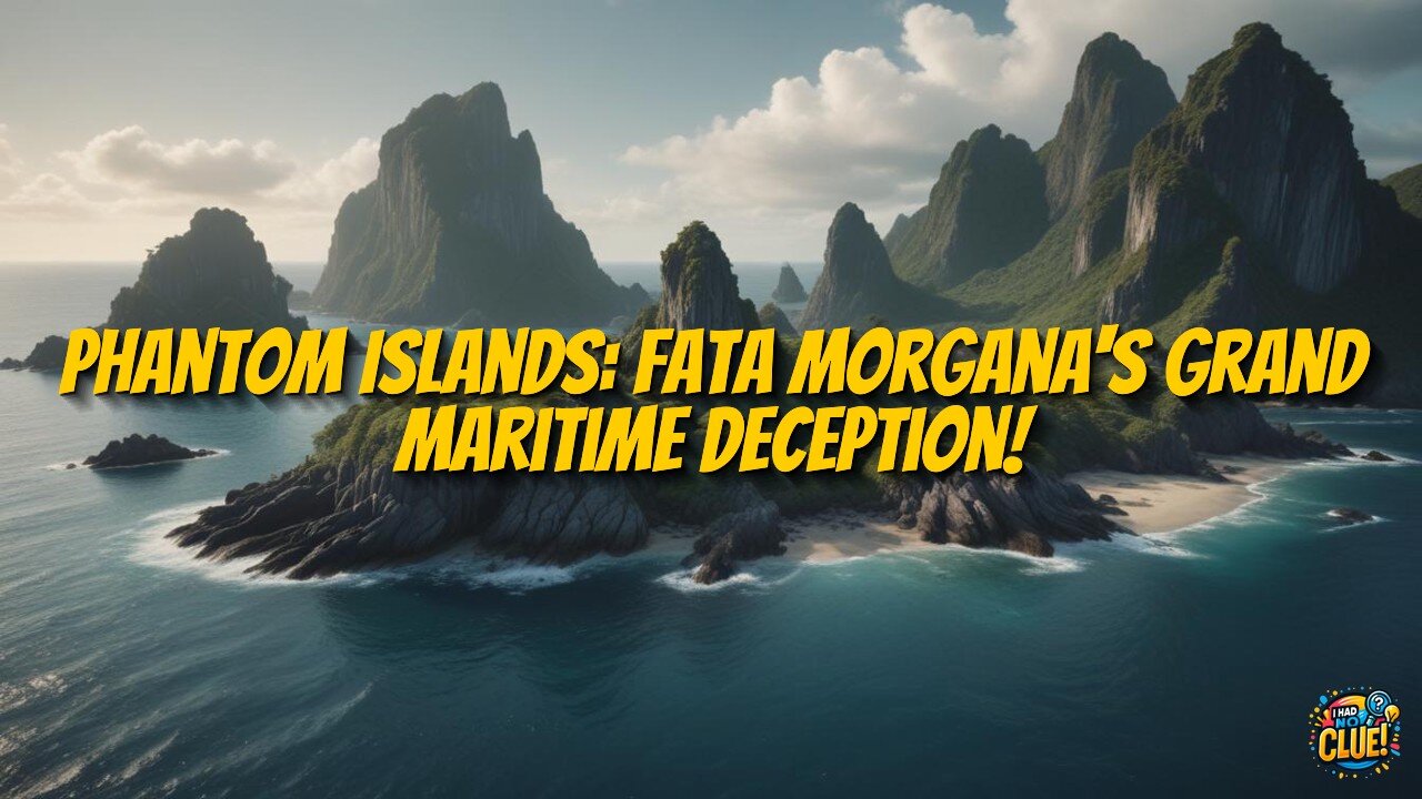
Phantom islands are a fascinating cartographic phenomenon where mysterious landmasses appeared on official maps for centuries before being proven nonexistent. Unlike purely mythical places, these islands were documented by credible navigators and accepted as geographical facts, sometimes persisting on charts for hundreds of years. Examples include Hy-Brasil west of Ireland (mapped from 1325-1873), the Isle of Demons near Newfoundland, and various Pacific phantom islands reported by respected mariners. Many can be explained by Fata Morgana, a complex atmospheric optical illusion where temperature inversions bend light rays, making distant objects appear distorted above the horizon. These stable mirages could persist for hours, allowing for detailed observation. The persistence of phantom islands on maps reflected both the limitations of pre-satellite cartography and sometimes political motivations, as colonial powers were eager to claim new territories. Though now removed from navigation charts, these non-existent lands continue to influence literature and folklore and remind us how human perception and technological limitations have shaped our understanding of geography.
-
 4:22
4:22
NAG Daily
13 hours agoSaving Grace #4 — Is The BIBLE Wrong?
3.15K5 -
 6:14
6:14
Sugar Spun Run
23 hours ago $0.29 earnedApple Cobbler
1.47K4 -
 31:26
31:26
Clownfish TV
6 days agoJimmy Kimmel GONE FOR GOOD?! Insider Claims Disney is DONE! | Clownfish TV
4.71K27 -
 7:53
7:53
Rethinking the Dollar
12 hours agoForget AI & War: This Is What Will Break You in 2026
9.33K4 -
 20:03
20:03
Bearing
7 days agoGIRLFRIEND Reveals Her SECRET KINK 😂 (It Doesn’t Go Well) 💥
8.31K84 -
 56:23
56:23
Coin Stories with Natalie Brunell
1 day agoLyn Alden: Bullish on Bitcoin & Hard Assets
9.95K -
 8:10
8:10
MattMorseTV
18 hours ago $14.20 earnedSchumer's PLAN just IMPLODED.
25.9K68 -
 2:11:52
Side Scrollers Podcast
20 hours agoYouTube ADMITS BLATANT Censorship + California Wants to FINE “Hate Speech” + More | Side Scrollers
82.5K18 -
 15:18
15:18
GritsGG
15 hours agoSweaty Quads w/ Bobby Poff!
18.5K6 -
 17:11
17:11
Nikko Ortiz
1 day agoIs Poverty Your Fault?
39.7K39