
Drone photogrammetry in practice - measurement with DJI Phantom 4 RTK in Nysa
2 months ago
5
Drone photogrammetry is a modern method of acquiring spatial data that offers remarkable accuracy and detail. Data processing is often a challenge for lower-performance computers due to the huge numbers of aerial images acquired. In this article, we will describe how to effectively deal with these challenges. 3DSurvey software was used to get accurate results even with limited hardware. The Nisa project used a DJI Phantom 4 RTK to perform three raids, each lasting about 20 minutes.
Loading comments...
-
 LIVE
LIVE
Total Horse Channel
17 hours ago2025 Reno Snaffle Bit Futurity | Saturday
4,027 watching -
 LIVE
LIVE
Major League Fishing
2 days agoLIVE Tackle Warehouse Invitationals Championship, Day 2
209 watching -
 LIVE
LIVE
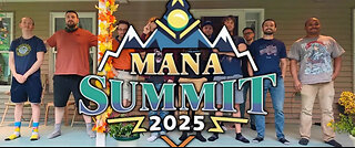
TheManaLord Plays
2 hours agoMANA SUMMIT - DAY 1 ($10,200+) | BANNED PLAYER SMASH MELEE INVITATIONAL
220 watching -
 2:35:48
I_Came_With_Fire_Podcast
16 hours agoCarolina Bays: The Lost Cataclysm You've Never Heard Of
18.1K6 -
![Mr & Mrs X - [DS] Trafficking Empire – The Pedo Network Island, The Cover-Up: Part 2 - Ep 6](https://1a-1791.com/video/fww1/f8/s8/1/y/p/x/f/ypxfz.0kob-small-Mr-and-Mrs-X-DS-Trafficking.jpg) 59:56
59:56
X22 Report
21 hours agoMr & Mrs X - [DS] Trafficking Empire – The Pedo Network Island, The Cover-Up: Part 2 - Ep 6
94.9K33 -
 1:03:07
Candace Show Podcast
1 day agoI’M BACK! And STILL Asking Questions (Sorry Brigitte). | Candace Ep 233
127K225 -
 13:13
13:13
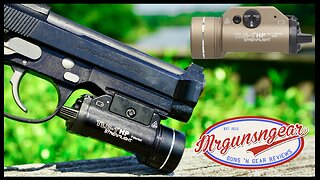
Mrgunsngear
20 hours ago $7.41 earnedStreamlight TLR-1 HP Review: Can It Dethrone Surefire?
52.4K11 -
 1:26:34
Man in America
23 hours agoExposing the Cover-Up That Could Collapse Big Medicine: Parasites
105K89 -
 1:12:09
Wendy Bell Radio
9 hours agoPet Talk With The Pet Doc
35.1K49 -
 27:15
27:15
Liberty Hangout
2 days agoThe Most DELUSIONAL Democrats on Earth!
57.1K172