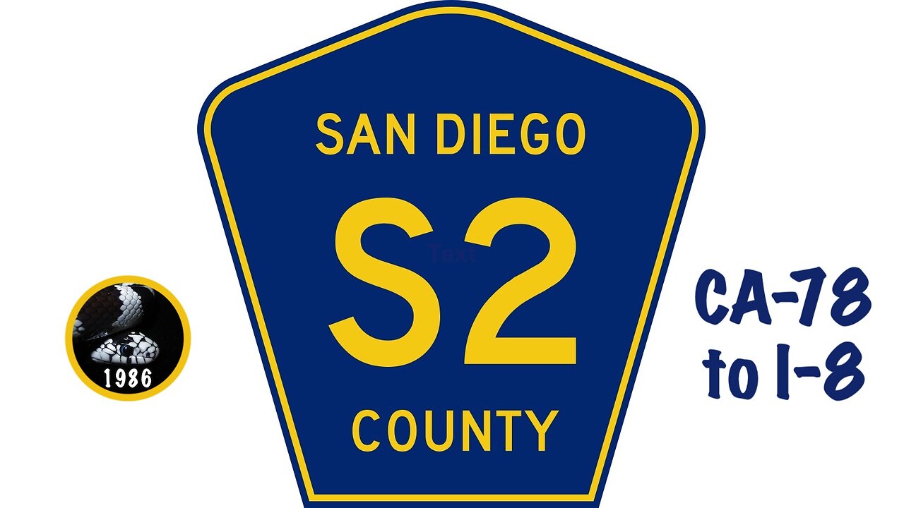
Driving San Diego County Route S2
Driving County Route S2, from Highway 78 south to Interstate 8. CR-S2 passes through Earthquake Valley, heads over Foot and Walker Pass into Blair Valley, climbs Box Canyon, crosses Mason Valley, ascends the Campbell Grade, traverses Vallecito Valley, then enters Carrizo Valley. Just past the summit of Sweeney Pass, on the east side of the road, is the most scenic part of the trip: The Carrizo Badlands. When CR-S2 enters Imperial County, it becomes known as Imperial Highway, passes beneath bird-chopping widmills, then ends in the hamlet of Ocotillo.
Blog: http://prestonm.com/san-diego-county-highway-s2/
Twitter: https://twitter.com/PrestonMcMurry
____________________
"When", Metre
https://freemusicarchive.org/music/Metre/aero/when/
https://creativecommons.org/licenses/by-nc-sa/4.0/
Twitter, @PrestonMcMurry, Blog, PrestonM.com, Driving, Dashcam, California, San Diego County, Anza-Borrego Desert, Earthquake Valley, Shelter Valley, Foot and Walker Pass, Blair Valley, Box Canyon, Mason Valley, Campbell Grade, Vallecito Valley, Carrizo Valley, Sweeney Pass, Carrizo Badlands
-
 LIVE
LIVE
Nikko Ortiz
18 minutes agoYou Have A GUN?! | Rumble Live
236 watching -
 LIVE
LIVE
Benny Johnson
1 hour ago🚨Pelosi SNAPS At Question About January 6th CRIMES, PANIC Across DC as Bolton Indictment Imminent
5,577 watching -
 1:01:18
VINCE
2 hours agoThe Numbers Don't Lie: Trump's War on Crime Is Working | Episode 148 - 10/16/25
135K56 -
 LIVE
LIVE
LFA TV
13 hours agoLIVE & BREAKING NEWS! | THURSDAY 10/16/25
4,568 watching -
 LIVE
LIVE
Bannons War Room
7 months agoWarRoom Live
12,028 watching -
 LIVE
LIVE
Badlands Media
7 hours agoBadlands Daily: October 16, 2025
3,788 watching -
 13:44
13:44
IsaacButterfield
6 hours ago $0.17 earnedI WENT ON KILL TONY
7692 -
 LIVE
LIVE
The Big Mig™
3 hours agoNever Mess With A Man’s Family, Donald J. Trump
5,183 watching -
 1:32:34
Dear America
3 hours agoDems Are IN SHAMBLES!!! Is NYC Electing a JIHADIST?! + FBI Cracks down on Crime!!
82.3K60 -
 2:20:39
Matt Kohrs
13 hours agoLive Trading Futures & Options || Stock Market Open
29.1K1