Gino Recchia NBC26 Storm Shield Weather Forecast
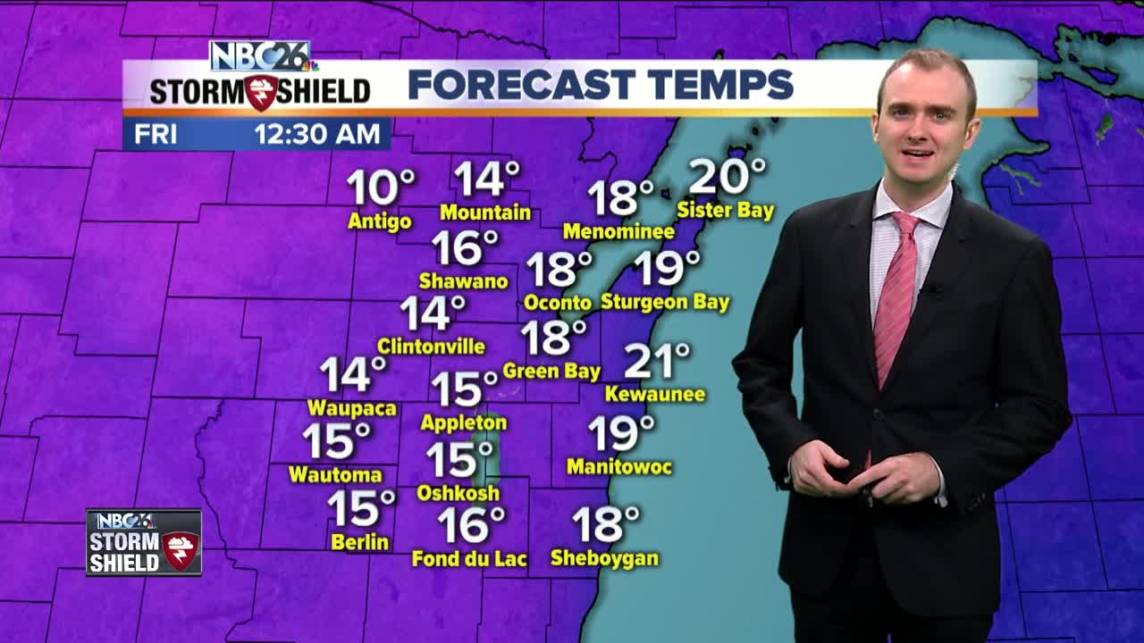
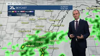
A few snow showers and flurries swept through Northeast Wisconsin overnight into early this morning. There could be a few additional flurries or a passing snow shower this afternoon but overall, it will be a quiet day. Temperatures will warm up into the mid 20s with mostly cloudy skies and winds out of the west and northwest around 5 to 15 mph. Tonight we will start to see the mercury drop as an arctic high pressure begins to move into the Midwest, bringing some of the coldest temperatures we have seen so far this season. There is a question that remains how cold we will get as skies will clear tonight but with winds out of the west around 5 to 10 mph, most of Northeast Wisconsin may stick around in the lower teens. If winds do calm down however, expect overnight lows in the single digits, even perhaps below zero further towards the Northwoods. Friday will be the coldest day of the whole week, with highs only topping off in the mid and upper teens. We will have winds out of hte west around 5 to 15 mph under an abundance of sunshine. There is some good news as we turn the page into the weekend and early next week. Temperatures will be on a gradual warming curve getting back into the lower and mid 20s for the weekend both under sunshine. Monday and Tuesday, highs will be in the upper 20s and on Wednesday, mid 30s return to the area.
-
 1:45
1:45
WGBA
1 year agoFond du Lac Cardinals start the football season with a new $5.3 million nest
360 -
 3:40
3:40
WGBA
4 years agoGino Recchia NBC26 Weather Forecast
5 -
 3:21
3:21
WGBA
3 years agoGino Recchia NBC26 Weather Forecast
3 -
 3:51
3:51
WGBA
4 years agoGino Recchia NBC26 Weather Forecast
1 -
 2:32
2:32
WGBA
4 years agoGino Recchia NBC26 Weather Forecast
6 -
 3:45
3:45
WGBA
4 years agoGino Recchia NBC26 Weather Forecast
14 -
 3:07
3:07
WGBA
4 years agoGino Recchia NBC26 Weather Forecast
9 -
 3:44
3:44
WGBA
4 years agoGino Recchia NBC26 Weather Forecast
8 -
 3:48
3:48
WGBA
4 years agoGino Recchia NBC26 Weather Forecast
-
 3:13
3:13
WGBA
4 years agoGino Recchia NBC26 Weather Forecast
63