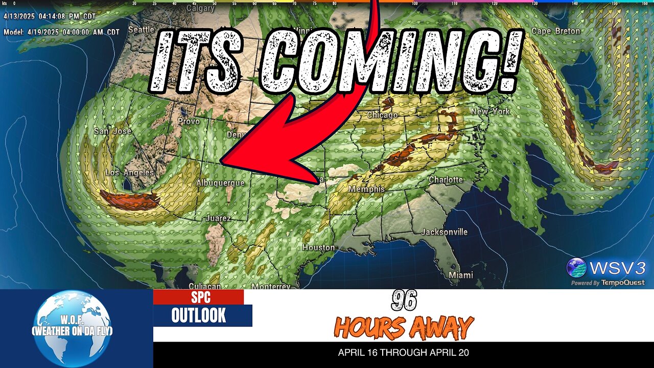
⚠️ Active Severe Weather Pattern Ahead! April 13
⚠️ Heads up, Kansas and Missouri! Severe storms are on the horizon this Thursday, with a powerful weather system bringing the potential for dangerous thunderstorms, strong winds, and hail. W.O.F. (Weather On da Fly) has your quick Severe Weather Outlook and Discussion, highlighting the high risk as a deep surface cyclone develops near Kansas and a surge of moisture fuels storm activity across the region. Stay tuned as this active pattern heads towards the weekend, with impacts extending from the southern high plains to the Great Lakes.
Your #1 Source for fast, reliable Severe/Tropical Weather Outlooks & Discussions, we’re here to keep you informed. Don’t miss out—#Share this crucial update, #Like to show your support, and #Subscribe for more real-time forecasts and the latest from NOAA, SPC, and NHC. Stay weather-ready this April 2025! 🌪️⛈️ #Weather #Outlook #HurricaneSeason
-
 1:17:49
vivafrei
4 hours agoEpstein Press Conference DEBACLE! Missing Minute FOUND? Canada Continues to Fall! & MORE!
74.7K54 -
 29:30
29:30
Stephen Gardner
2 hours ago🟢YES! Trump’s Doing It! Ben Shapiro UNLEASHES on Democrat STUPIDITY!
19.5K14 -
 LIVE
LIVE
Dr Disrespect
6 hours ago🔴LIVE - DR DISRESPECT - METAL EDEN - NEW 2025 SCI-FI FPS LAUNCH STREAM
1,101 watching -
 LIVE
LIVE
StoneMountain64
4 hours agoBattlefield's Easter Egg Phantom Project is STILL ALIVE
99 watching -
 LIVE
LIVE
LFA TV
11 hours agoLFA TV ALL DAY STREAM - WEDNESDAY 9/3/25
1,269 watching -
 LIVE
LIVE
freecastle
7 hours agoTAKE UP YOUR CROSS- Love...Light...TRUTH!
165 watching -
 1:50:29
The Quartering
4 hours agoEpstein Victims To NAME People, Mutiny Over RFK Jr, Trump Turns On Warp Speed?
130K43 -
 1:33:30
Film Threat
22 hours agoMARVEL ZOMBIES! PLUS DEXTER RESURRECTION | Hollywood on the Rocks
12.7K -
 1:06:51
Jeff Ahern
3 hours ago $0.78 earnedNever Woke Wednesday with Jeff Ahern
19K -
 13:43
13:43
The Kevin Trudeau Show Limitless
8 hours agoClassified File 3 | Kevin Trudeau EXPOSES Secret Society Brainwave Training
37.1K6