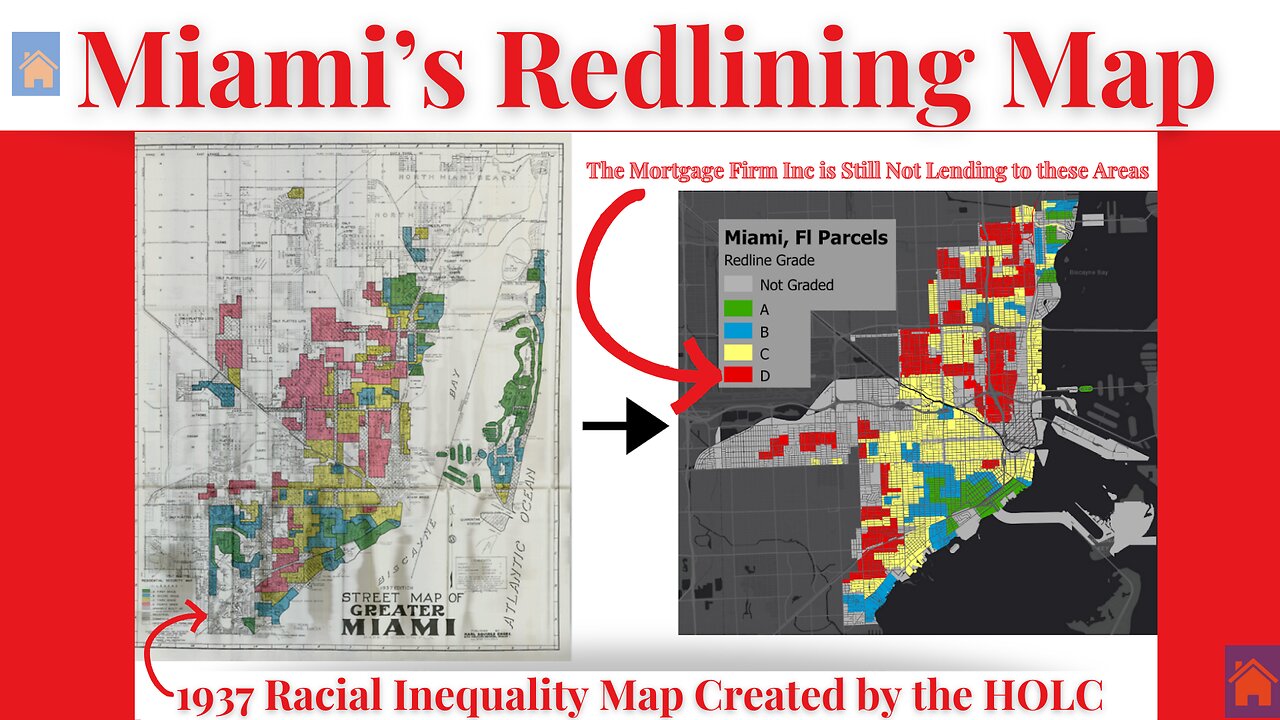
Decoding Miami’s 1937 Redlining Map
5 months ago
243
In this clip, I break down Miami’s 1937 redlining map, explaining the map legend and revealing which neighborhoods were systematically redlined. From Overtown to Liberty City, these discriminatory zoning practices shaped Miami’s racial and economic landscape for decades. Watch as I analyze the historical data and discuss the long-term impact of these policies on housing, wealth, and community development.
🔴 Subscribe for more deep dives on redlining, mortgage discrimination, and housing justice.
#MiamiRedlining #HousingDiscrimination #FairHousing #HistoryMatters
Loading 5 comments...
-
 DVR
DVR
Man in America
9 hours agoSoaring Gold Exposes the Imminent Crash of the Old System w/ John Perez
15.7K -
 LIVE
LIVE
TruthStream with Joe and Scott
10 hours agoTHOMAS AND GROK: AI, Bible decodes, The JESUS Cube live 9/6: 7pm pacific 10 pm Eastern
151 watching -
 LIVE
LIVE
BlackDiamondGunsandGear
4 hours agoGet Prepped / After Hours Armory / LIVE SHOW /
53 watching -
 LIVE
LIVE
Tundra Tactical
3 hours ago $0.68 earned🛑LIVE NOW!! This spits in the face of the Second Amendment.🛑
148 watching -
 LIVE
LIVE
DLDAfterDark
2 hours agoIt's SHTF! Do You Have What You Need?? Let's Review Items & Priorities
96 watching -
 28:58
28:58
Stephen Gardner
3 hours ago🚨Explosive allegations: Rosie O’Donnell connects Trump to Epstein scandal!?
4.54K31 -
 LIVE
LIVE
SavageJayGatsby
1 day agoSpicy Saturday | Let's Play: Grounded
626 watching -
 2:06:27
MattMorseTV
4 hours ago $37.17 earned🔴Vance just went SCORCHED EARTH.🔴
110K138 -
 46:41
46:41
The Mel K Show
9 hours agoMel K & Corey DeAngelis | The Hopelessly Captured Teacher’s Unions: Biggest Threat to Our Children & Future | 9-6-25
22.3K3 -
 2:52:42
Mally_Mouse
1 day ago🔥🍺Spicy HYDRATE Saturday!🍺🔥-- Let's Play: Grounded
23.5K2