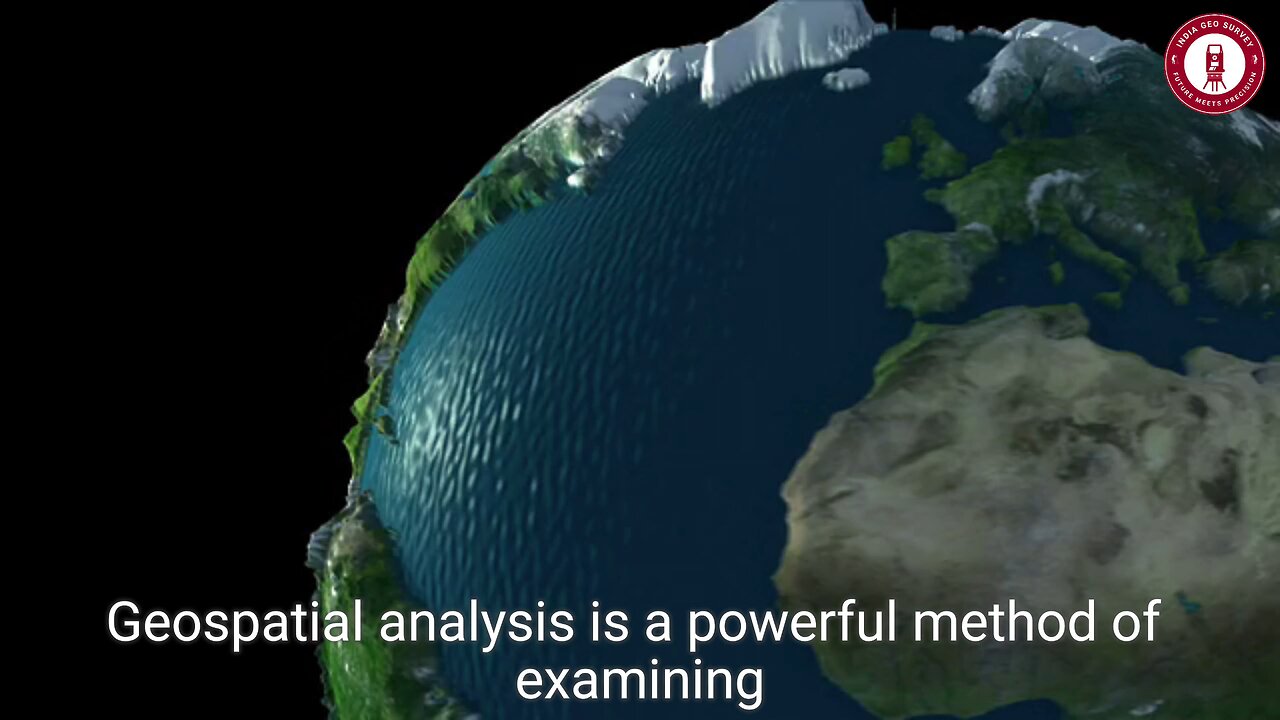
🌍 Unlock the Power of Geospatial Analysis!
Geospatial analysis is revolutionizing decision-making, urban planning, and environmental conservation by turning location-based data into actionable insights! Whether you're tracking urban expansion, disaster response, or climate change, this powerful technique helps you see the world like never before. 🔍🌎
📊 How to Master Geospatial Analysis?
✅ 📥 Gather Your Data
Start by collecting satellite imagery, GPS data, open-source maps, or even geotagged social media posts! Convert them into shapefiles or GeoJSON for seamless integration with GIS tools like QGIS or ArcGIS.
✅ 🗺️ Visualize to Uncover Hidden Patterns
Raw data is just numbers—but maps bring it to life! Use GIS tools to overlay multiple datasets and reveal patterns, correlations, and trends. Imagine mapping pollution levels against population density or tracking deforestation over time—the insights are game-changing!
✅ 📍 Perform Spatial Analysis
Leverage buffering, overlay analysis, spatial queries, and distance calculations to gain deeper insights. Want to find the best location for a new hospital or determine which areas are most vulnerable to flooding? Spatial analytics has the answers!
✅ 🔥 Use Spatial Statistics for Precision
From hotspot detection to clustering analysis, spatial statistics quantify patterns and trends. This helps validate findings, ensuring that decisions are based on data-driven evidence, not just intuition.
✅ 🎥 Tell a Story with Your Findings
Data is powerful—but only when communicated effectively! Transform your insights into compelling maps, interactive dashboards, and dynamic reports to engage stakeholders and drive impactful decisions.
🚀 Why Geospatial Analysis is the Future?
🔹 Smarter Cities: Optimize transportation, utilities, and infrastructure
🔹 Disaster Response: Track wildfires, floods, and earthquakes in real-time
🔹 Sustainable Development: Protect natural resources and plan eco-friendly projects
🔹 Business Intelligence: Analyze consumer behavior, market trends, and supply chains
🌍 Start exploring the world through a geospatial lens today! 🛰️
#GeospatialAnalysis #GIS #Mapping #BigData #SpatialIntelligence #UrbanPlanning #SmartCities #QGIS #ArcGIS #TechInnovation 🚀
-
 22:42
22:42
Benjamin Sahlstrom
1 day ago $9.37 earnedHow To Refill 1lb Portable Propane Tanks!
64.2K10 -
 46:39
46:39
The Bold Lib
1 day agoOwen Shroyer: BOLDTALK W/Angela Belcamino
5.74K13 -
 7:57
7:57
Blackstone Griddles
1 day agoDouble Barrel Sausage Sandwich | Blackstone Griddles
16K1 -
 32:24
32:24
Forrest Galante
12 hours agoHunting and Eating The World's WORST Fish (Everglades At Night)
104K7 -
 32:10
32:10
Nikko Ortiz
17 hours agoSecret Agent Infiltrates Neo-Nazis...
20.4K16 -
 15:04
15:04
MetatronGaming
1 day agoOriginal Commodore 64 VS C64 Maxi - Review and Comparison
26.9K9 -
 9:46
9:46
MattMorseTV
15 hours ago $21.20 earnedTrump just SHUT DOWN a $287,000,000 FRAUD RING.
30.4K85 -
 15:48
15:48
GritsGG
17 hours agoWinning a Rare Solos Prison End Game on Warzone!
22.8K3 -
 11:37
11:37
The Pascal Show
17 hours ago $7.52 earnedTHEY WANT TO END HER?! Candace Owens Claims French President & First Lady Put A H*t Out On Her?!
25.1K23 -
 LIVE
LIVE
Lofi Girl
2 years agoSynthwave Radio 🌌 - beats to chill/game to
516 watching