Premium Only Content

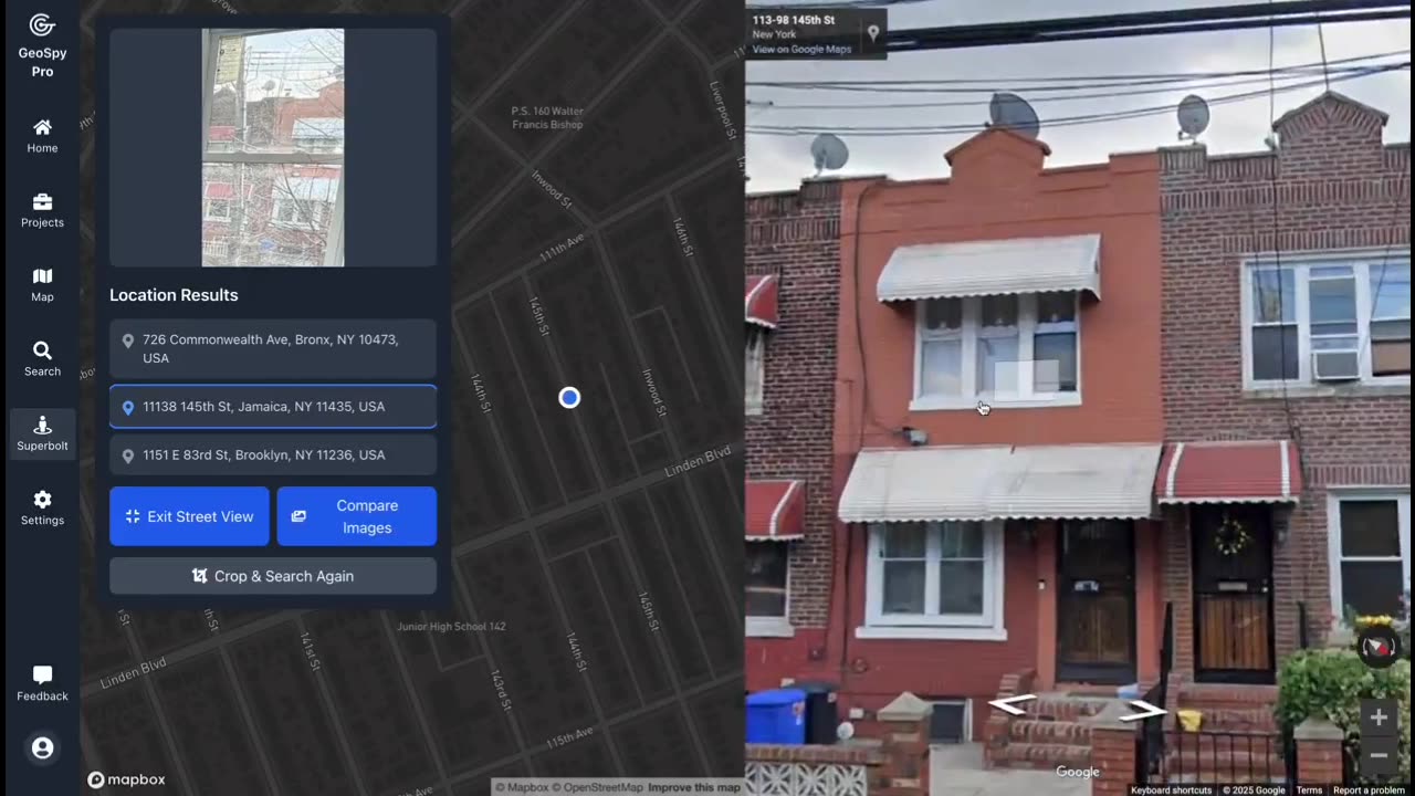
Open Source Intelligence (OSINT🌐) Finding the exact location with just a picture using GeoSpy.AI
EDUCATIONAL PURPOSES ONLY!!!
Open Source Intelligence (OSINT).
🔍 How it works: GeoSpy.ai uses artificial intelligence to process vast amounts of open-source geospatial data in real-time. By analyzing satellite images, geographic information systems (GIS), and online data sources, it identifies patterns, tracks movements, and extracts actionable intelligence without the need for proprietary or classified information.
💡 Applications of GeoSpy.ai in OSINT:
Surveillance & Monitoring: Track locations, movements, and events globally, from natural disasters to political developments.
Crisis Management: Assess areas impacted by emergencies, conflicts, or humanitarian issues by analyzing satellite imagery and social media data.
Geopolitical Analysis: Monitor shifts in urban landscapes, infrastructure development, and international borders.
Environmental Intelligence: Detect deforestation, pollution, climate change effects, and more by analyzing geospatial data.
GeoSpy.ai is the tool OSINT professionals rely on to make sense of the world's complex, interconnected data – all sourced from publicly available platforms. With its AI-driven capabilities, it transforms raw data into insightful intelligence.
🌐 Harness the power of open-source geospatial data for deeper, more informed decision-making with GeoSpy.ai.
#GeoSpyAI #OSINT #GeospatialIntelligence #OpenSourceIntelligence #AI #SatelliteImagery #DataAnalytics #IntelligenceCo
-
 LIVE
LIVE
Graham Allen
1 hour agoEpstein Files WILL BE RELEASED!! Not How You Think! + Kirk’s Head Of Security Exposes ALL!!
18,921 watching -
 LIVE
LIVE
Wendy Bell Radio
5 hours agoTruth Is A 4 Letter Word
7,152 watching -
 1:10:39
Chad Prather
14 hours agoRise and Walk, What Happens When Jesus Interrupts Your Normal
60.5K51 -
 LIVE
LIVE
LFA TV
12 hours agoLIVE & BREAKING NEWS! | WEDNESDAY 11/19/25
3,218 watching -
 16:09
16:09
Nikko Ortiz
1 day agoMilitary Fails That Got Soldiers In Trouble
26.6K12 -
 LIVE
LIVE
PudgeTV
3 hours ago🟣 Arc Raiders - Gaming on Rumble | The Rumskateers Go Topside
79 watching -
 LIVE
LIVE
Reidboyy
11 hours ago24/7 BO7 Camo Grind! Stream Doesn't End Until I Unlock EVERY Camo in Black Ops 7!
110 watching -
 1:05:07
Julie Green Ministries
3 hours agoLIVE WITH JULIE
75.2K139 -
 LIVE
LIVE
WorldofGaming
1 day agoTHE ULTIMATE MARIO KART WORLD MARATHON!
121 watching -
 2:49:34
Country Craft Streams
3 hours agoJunkyard Juggernaut Clash
3K