🌩️ Today: Marginal Severe Storm Risk for Central Florida! March 10
🌩️ Stay ahead of today’s Marginal Severe Storm Risk for Central Florida with W.O.F. (Weather On da Fly)! A mid-level low and cold front are bringing increased instability, setting the stage for surface-based thunderstorms across the region. Expect storms late morning into early afternoon, with isolated severe gusts and even a brief tornado possible. Shear up to 50 knots and warming temperatures create the perfect blend for a marginal severe threat. Don’t worry—conditions will calm as the stronger low-level flow moves offshore later today.
Your #1 Source for quick Severe/Tropical Weather Outlooks & Discussions, W.O.F. keeps you informed on all things weather, from Central Florida’s storms to updates on the SPC, NOAA, NHC, and beyond. Stay tuned as we track conditions through March 2025, including hurricane forecasts and seasonal outlooks.
CHAPTERS:
00:00 - Intro
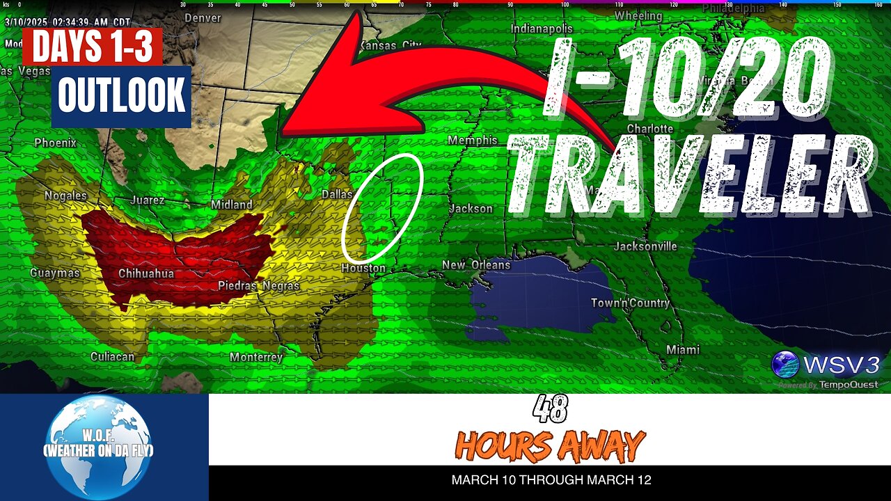
00:06 - Today's Convective Outlook
01:14 - Tuesday's Weather Forecast
01:55 - Wednesday's Weather Update
03:17 - Outro
-
 LIVE
LIVE
SpartakusLIVE
1 hour agoVerdansk Duos w/ Nicky || Saturday Spartoons - Variety Later?!
396 watching -
 1:32:54
Jeff Ahern
3 hours ago $24.16 earnedThe Saturday Show with Jeff Ahern
70.1K8 -
 LIVE
LIVE
TheManaLord Plays
5 hours agoMANA SUMMIT - DAY 1 ($10,200+) | BANNED PLAYER SMASH MELEE INVITATIONAL
287 watching -
 LIVE
LIVE
Major League Fishing
2 days agoLIVE Tackle Warehouse Invitationals Championship, Day 2
132 watching -
 LIVE
LIVE
GamerGril
2 hours agoScream Queens 💕 Goth & Gore 💕 Unpossess
146 watching -
 LIVE
LIVE
CassaiyanGaming
5 hours agoMYSTIVITHON - 12 HOUR CHARITY STREAM 🌊
53 watching -
 2:14:16
Lara Logan
18 hours agoSTANDING AGAINST THE GLOBAL ELITE with Trump Ally President Milorad Dodik of Republika Srpska | Ep34
26.2K12 -
 LIVE
LIVE
FoeDubb
4 hours ago🏰KINGDOM MENU: 👑CHILL CONVO 🎮DELTA FORCE PEW PEWS WITH THE HOMIE ARROWTHORN DILLY DILLY!!!
26 watching -
 1:56:00
PixiEars_
2 hours agoBDAY STREAM
5.03K2 -
 LIVE
LIVE
Total Horse Channel
20 hours ago2025 Reno Snaffle Bit Futurity | Saturday
1,554 watching