🏗️ Land Surveying Explained: The Backbone of Construction & Real Estate! 🌍📏
🌎 Ever wondered how land is measured with pinpoint accuracy? Land surveying is the key to precision in real estate, construction, and infrastructure projects! From property boundaries to topographic mapping, surveyors play a crucial role in shaping the world around us. 🏡🏗️
📌 Types of Land Surveying You NEED to Know:
✅ Boundary Surveying – Defining property lines & preventing disputes 🏡🗺️
✅ Topographic Surveying – Mapping terrain & elevation for smart planning 🌿🏞️
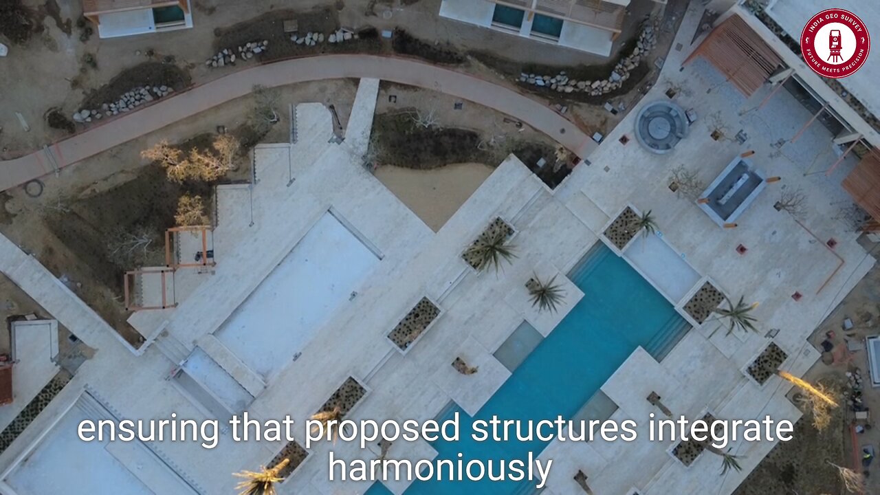
✅ Construction Surveying – Ensuring buildings align with project blueprints 📐🏗️
✅ Hydrographic & Geodetic Surveys – Exploring underwater & large-scale mapping 🌊🌍
💡 Why Land Surveying is Essential:
📌 Avoid legal disputes with precise boundary identification 📜
📌 Improve construction accuracy & safety 🚧
📌 Optimize land use for urban planning & sustainability 🏙️
🚀 Technology like GPS, drones, and total stations has revolutionized the surveying industry, making it faster & more accurate than ever!
💬 Which type of land surveying interests you the most? Drop a comment below! ⬇️
🔔 LIKE, SHARE & SUBSCRIBE for more insightful content on land surveying & GIS!
💥 Hashtags:
#LandSurveying #Surveying #Construction #RealEstate #GIS #Mapping #TopographicSurvey #CivilEngineering #Drones #GPSMapping #Infrastructure #UrbanPlanning #GeospatialTech #HydrographicSurvey #PropertyLines
-
 2:21:39
Inverted World Live
9 hours agoThe Clone and Alien Invasion | Ep. 51
78.8K17 -
 2:42:59
TimcastIRL
10 hours agoTrump SLAMS Biden Over Boulder TERROR Attack, Protecting Illegals & Leftists | Timcast IRL
192K50 -
 LIVE
LIVE
TylerTodayNews
3 hours ago $0.02 earnedHorror game with friends! Then fighting the galactic war | REPO & Helldivers 2 | Tyler Today Games
294 watching -
 LIVE
LIVE
TheBeardedBrent
1 hour ago🔴LIVE🔥 | WARZONE | THE CASUAL KING | ROAD TO 50 SUBS!!🔥
145 watching -
 2:57:28
Barry Cunningham
10 hours agoTRUMP WORLD END OF THE DAY NEWS AND SPECIAL GUEST JOHN AMANCHUCKWU!
87.1K73 -
 8:39:34
SpartakusLIVE
12 hours agoSPECIALIST Easter Egg ALL DAY || Duos w/ StevieT
52.6K1 -
 1:14:47
FreshandFit
10 hours agoTop 5 Business Credit Cards
88.9K8 -
 5:32:23
iCheapshot
9 hours ago $2.97 earnedPart 2 of a12cat34dog's Ben and Ed No Rage Quit Challenge!
50.9K -
 1:49:53
Glenn Greenwald
13 hours agoDOGE: Promises vs. Reality; Ukraine's Drone Attacks on Russian Air Bases; Gaza Ceasefire Deal Developments | SYSTEM UPDATE #463
146K94 -
 2:13:34
RiftTV/Slightly Offensive
12 hours agoZelensky Declares WAR on RUSSIA.. Trump FUMING Over Surprise ATTACK | The Rift | Guest: Sarah Stock
78.8K98