NBC26 Storm Shield Weather Forecast
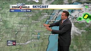
A large area of precipitation will be heading this way bringing the first area-wide snowfall event to Northeast Wisconsin. Light to moderate snow at times will begin after midnight and continue on and off throughout the day Friday with high temperatures right around freezing. It will also get windy, northwest winds around 20 to 30 mph with higher gusts are possible. We are still having some disagreement on the duration of this snow system so right now snowfall accumulations range from just a dusting to as much as a few inches. Highest amounts are expected along the lakeshore & especially Door County. A few passing flurries will kick off the weekend with high temperatures in the upper 20s to lower 30s. On Sunday, we have the potential to have another round of light snow. There is also some disagreement here in regards to the coverage locations. This only looks to add another light dusting . Next week will remain cold with cloudy skies to start off, gradually turning more sunny further towards the middle part of the week. At times high temps will be running 15-20° below normal for mid November!!
-
 4:04
4:04
WGBA
5 years agoNBC26 Storm Shield weather forecast
1 -
 3:39
3:39
WGBA
5 years agoNBC26 Storm Shield Weather Forecast
3 -
 2:16
2:16
Mohibbanchannels
4 months agoThundersnow Storm
271 -
 1:50:50
Source Global News
1 year agoLive Coverage: Winter Storm Elliot from Waukesha Wisconsin
2 -
 12:19
12:19
Great Lakes Weather
2 years agoMore Active Weather Ahead, Thunderstorms AND Snow in One Week -Great Lakes Weather
4 -
 2:41
2:41
FunnelFanatics
10 months agoSevere Weather Forecasting
85 -
 8:36
8:36
TiffanysContent
5 months agoDaily Weather Update: Snowstorm, Tornadoes, Thunderstorms, LIGHTNING, Heavy Rainfall, Black Ice, FOG
39 -
 17:25
17:25
Great Lakes Weather
11 months agoSevere Weather Potential Next Week with a Possible Heat Wave To Come -Great Lakes Weather
34 -
 0:40
0:40
AsianPatriot28
3 years agoAfter the snow storm
271 -
 15:40
15:40
Great Lakes Weather
11 months agoSupercell Sunday: Severe Weather Potential for Michigan and Indiana -Great Lakes Weather
14