RAINFOREST HIKING (4K) Salmon River Trail! | Salmon-Huckleberry Wilderness | Mount Hood NF | Oregon
0:00 Hiking Rocky Shoreline of Salmon River Trail!
1:11 Fork in the Trail, Take Path of Least Resistance
2:18 Do Low Elevation River Hikes in Spring to Save the Summer Slots of Alpine Hiking
3:00 Minor Waterfall & Trail Perspective of National Wild & Scenic Salmon River
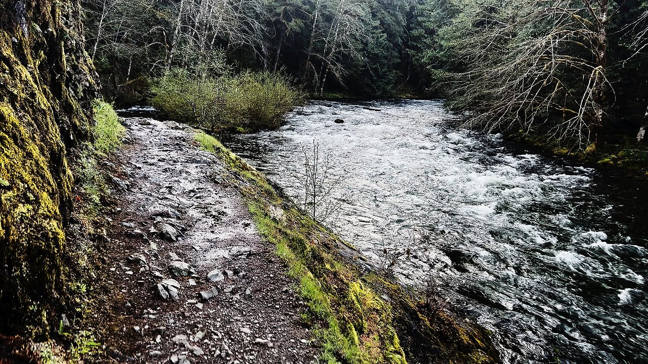
4:07 Shoreline Perspective of National Wild & Scenic Salmon River
4:29 Gnarly Moss Covered Rainforest Wonderland of Salmon-Huckleberry Wilderness
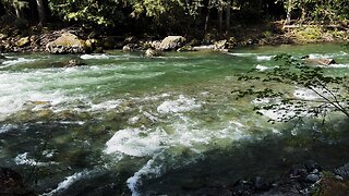
4:50 "Silent Perspectives" Montage of 6 Unique 4K Clips of National Wild & Scenic Salmon River from Salmon River Trail
This was a Day Hike in the Salmon Huckleberry Wilderness, Mount Hood National Forest, Oregon, starting @ Salmon River Trailhead (West) and Hiking parallel to and above National Wild & Scenic River Salmon Rive through a very rocky Old Growth Rainforest! This River Wilderness Trail goes on for dozens of Miles and is a very high quality backpacking zone, however if you want to just do a Day Hike, I would suggest one of three Hike Plan options:
*"Short"* (about 7.6 miles)
*"Medium"* to Goat Creek Camp (a little over 9 miles)
*"Long"* to the Trail Junction of Kinzel Lake, Devil's Tooth, and Devil's Peak (about 11.2 miles)
*"Ultra"* to Kinzel Lake (about 15.3 miles) - theoretically you could turn it into a loop and come back to to the North of Salmon River Trail by Devil's Peak on Hunchback Trail, but that makes it a MUCH Longer Hike and I've read bad things about the quality of that upper half of the loop, so do so at your own risk.....I'd prefer to come back on Salmon River Trail, and if one wants to visit Devil's Peak there are other much shorter Hike approaches to that destination, particularly from the East of 2.6 Miles (although it's a rough road)
The Elevation starts around 1600 FT and goes to around 2600 FT, and with the natural machinations of the Old Growth Rainforest Trail you gain about 1200 feet in Elevation (for "Long") which I would consider "Moderate". This Trail is accessible as early as February in some years, often in the March/April/May Spring range, of course, based on the annual snow levels.
The sky was overcast with a High of 50F and Low of 34F, I arrived a little after sunrise at 34F. This was Hiked on 5/11/2022 and there were of course NO Mosquitoes!
As far as road conditions, it's Highway to the turn off for Salmon River which is a paved road with a few bumps along the way until the parking lot gravel area, so it was a very easy and safe driving route. In my opinion, the road most definitely DOES NOT require 4-Wheel Drive, however do watch for road conditions, particularly snow/ice depending on the time of year, and of course do so at your own risk!
Here is the FULL PLAYLIST of Salmon River Trail:
https://www.youtube.com/playlist?list=PLuGUSVzluAAltQi0wvdh1Klp6ldq1VOZI
-
 7:26
7:26
HikingViking
11 days ago(4K UHD) SILENT PERSPECTIVES @ Douglas Fir Campground! | Nooksack River | Mt. Baker-Snoqualmie NF
58 -
 8:17
8:17
Due Dissidence
15 hours agoPalantir is a CREATION of Post-9/11 Hysteria - w/ Derrick Broze | TMWS
5.73K5 -
 7:00
7:00
Zach Costello
17 hours agoMedia CAUGHT Covering Up ATTACK on Homeland Security Secretary
6.32K5 -
 12:05
12:05
Matt Kohrs
17 hours agoHow I Became A Profitable Trader (3 Simple Steps)
6.1K -
 5:22:44
GloryJean
19 hours agoMnK #1 Aggressive POV 🖱️ 6.7 K/D
10.3K -
 9:03
9:03
PragerU
13 hours agoAnti-ICE Organizers Exposed, U.S.–China Deal Reached, Hamas Kills Humanitarians: 6/13/25
9.15K1 -
 24:06
24:06
This Bahamian Gyal
13 hours agoEven BLACK PEOPLE are fed-up with BLACK PEOPLE
10.5K13 -
 0:55
0:55
Turning Point USA
16 hours agoRACE WAR | Official Trailer
8.89K1 -
 20:24
20:24
The BOB & TOM Show
1 day agoGerman Accents, Poop in a Shoebox & Plane Gender Reveal?! | BOB & TOM Show
7.11K1 -
 6:01:10
FyrBorne
1 day ago🔴Warzone Sniping: The Players Are Now The Anti Cheat
6.68K