NBC26 Storm Shield Weather Forecast
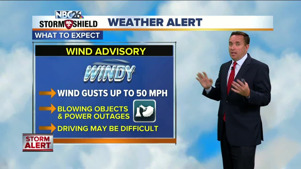
A cold front approaching late in the day will trigger thunderstorms. We will have to keep an eye on those as any that develop could possibly be severe. The threats this evening are all types of severe weather including damaging winds, hail or possibly a tornado. A strong cold front will be sweeping through tonight bringing a round of T'storms for most of the area. Some of these in the evening could be severe. After this front passes, the threat of severe weather will diminish and the temperatures will plummet into the 40s with gusty NW winds. Thursday looks quiet and cooler with finally some sunshine and highs in the low- to mid-50s. Rain rolls back in on Friday with highs in the mid-50s. This chance of rain will continue through the weekend, but the computer models are not in good agreement of when the best chances of rain will be. Weekend temps may struggle to make it to 60. With this unusually active pattern to start the month, there is the potential for this October to be one of the wettest Octobers on record, and we're just getting started.
-
 0:30
0:30
WGBA
1 year agoThree Degree Guarantee
360 -
 3:52
3:52
WGBA
4 years agoGino Recchia NBC26 Weather Forecast
10 -
 3:10
3:10
WGBA
4 years agoGino Recchia NBC26 Weather Forecast
3 -
 3:51
3:51
WGBA
4 years agoGino Recchia NBC26 Weather Forecast
17 -
 3:34
3:34
WGBA
4 years agoGino Recchia NBC26 Weather Forecast
11 -
 4:01
4:01
WGBA
4 years agoGino Recchia NBC26 Weather Forecast
15 -
 3:11
3:11
WGBA
4 years agoGino Recchia NBC26 Weather Forecast
5 -
 3:33
3:33
WGBA
4 years agoGino Recchia NBC26 Weather Forecast
4 -
 3:45
3:45
WGBA
4 years agoGino Recchia NBC26 Weather Forecast
1 -
 4:02
4:02
WGBA
4 years agoGino Recchia NBC26 Weather Forecast
8