NBC26 Storm Shield Weather Forecast
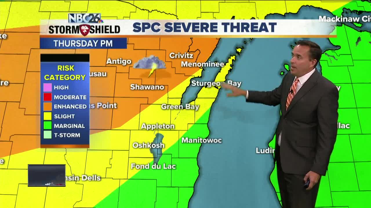
A warm front will be approaching the area tonight slowly increasing our chances of thunderstorms. It looks like it could be another soaker with locally heavy rainfall as the night wears on. Some flooding is possible.....especially across parts of Brown county. Thursday, a strong area of low pressure will be rolling through bringing parts of the area into the warm sector during the afternoon. After the morning showers move out, we'll have to see what redevelops in the afternoon. Anything that would could be strong to severe. Highs will top out near 80 the farther south you live with more humidity and windy conditions. That threat of strong to severe T'storms will continue into Thursday night with locally heavy rainfall possible. This is all going to depend how far we make it into the warm sector of this system and how quickly the cold front will pass through. Friday, will be cooler and windy with mostly cloudy skies & perhaps an very early shower. Highs will only top out in the mid-60s. Friday night is going to be a chilly one with possibly some patchy frost in spots. Lows will be around 40, with 30s possible north. Saturday looks cooler and quiet with highs in the low-60s with plenty of sun. Sunday will also be dry with temps bumping up to 70.
-
 0:30
0:30
WGBA
1 year agoThree Degree Guarantee
369 -
 3:34
3:34
WGBA
4 years agoGino Recchia NBC26 Weather Forecast
11 -
 3:11
3:11
WGBA
4 years agoGino Recchia NBC26 Weather Forecast
5 -
 3:33
3:33
WGBA
4 years agoGino Recchia NBC26 Weather Forecast
4 -
 3:45
3:45
WGBA
4 years agoGino Recchia NBC26 Weather Forecast
1 -
 4:02
4:02
WGBA
4 years agoGino Recchia NBC26 Weather Forecast
8 -
 3:46
3:46
WGBA
4 years agoGino Recchia NBC26 Weather Forecast
6 -
 3:46
3:46
WGBA
4 years agoGino Recchia NBC26 Weather Forecast
15 -
 2:44
2:44
WGBA
4 years agoGino Recchia NBC26 Weather Forecast
5 -
 3:12
3:12
WGBA
4 years agoGino Recchia NBC26 Weather Forecast
2