
NBC26 Storm Shield Weather Forecast
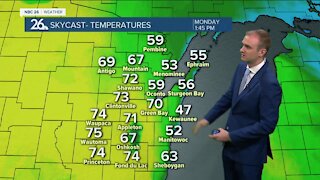
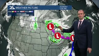
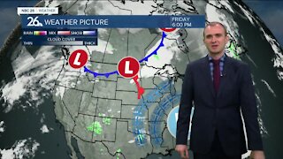
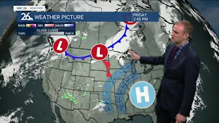
We traded 90s in for 60s on Tuesday & the cooler weather will stick around for Wednesday. Tonight there will be a chance of a hit or miss shower or stray T'storm with lows in the mid-50s. Wednesday, a much stronger area of low pressure will be approaching the area slowly increasing our chances of a shower or T'storm as the day progresses. It'll be breezy with highs in the mid 60s. Wednesday night looks like it could be another soaker with locally heavy rainfall as the night wears on. Lows will be around 60. Thursday, that strong low pressure will be rolling through bringing parts of the area into the warm sector during the afternoon. After the morning showers move out, we'll have to see what redevelops in the afternoon. Anything that would could be strong to severe. Highs will top out around 80 with more humidity and windy conditions. That threat of strong to severe T'storms will continue into Thursday night with locally heavy rainfall possible. Friday, will be cooler and windy with mostly cloudy skies & perhaps an early shower.
-
 0:30
0:30
WGBA
1 year agoThree Degree Guarantee
319 -
 3:34
3:34
WGBA
4 years agoGino Recchia NBC26 Weather Forecast
11 -
 3:11
3:11
WGBA
4 years agoGino Recchia NBC26 Weather Forecast
5 -
 3:33
3:33
WGBA
4 years agoGino Recchia NBC26 Weather Forecast
4 -
 3:45
3:45
WGBA
4 years agoGino Recchia NBC26 Weather Forecast
1 -
 4:02
4:02
WGBA
4 years agoGino Recchia NBC26 Weather Forecast
8 -
 3:46
3:46
WGBA
4 years agoGino Recchia NBC26 Weather Forecast
6 -
 3:46
3:46
WGBA
4 years agoGino Recchia NBC26 Weather Forecast
15 -
 2:44
2:44
WGBA
4 years agoGino Recchia NBC26 Weather Forecast
5 -
 3:12
3:12
WGBA
4 years agoGino Recchia NBC26 Weather Forecast
2