Michael Fish's NBC26 Storm Shield weather forecast
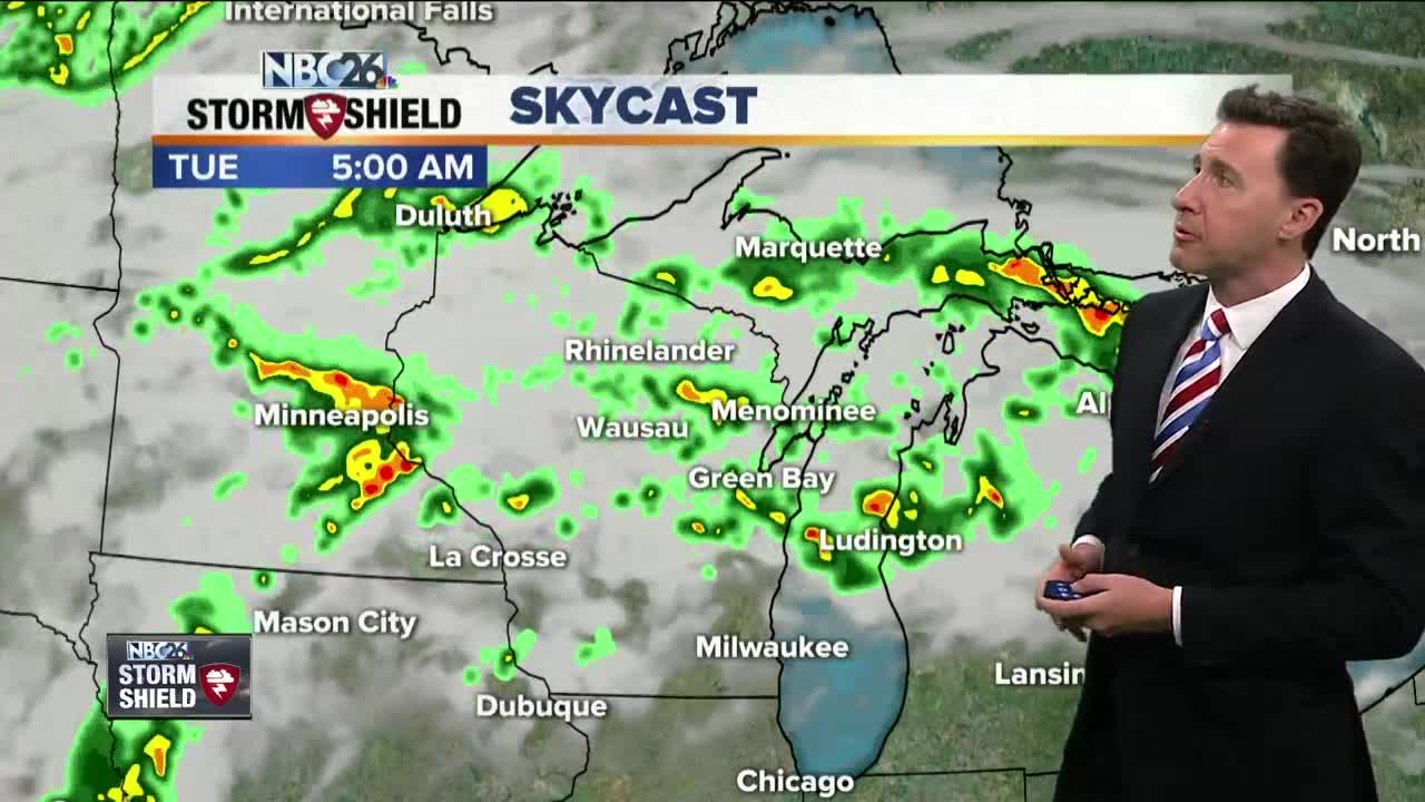
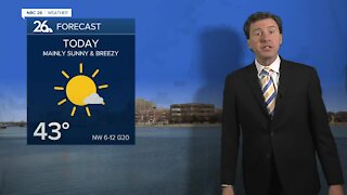
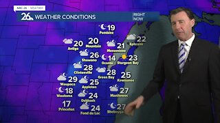
We have a frontal boundary that has pushed south of the area for the daytime hours today. That means, though today won't be perfect, we'll have a bit of a lull in the rain for a lot of your daytime hours. There's a slight chance of a later afternoon shower or T'storm mainly to the south, but even there, it won't be a wash today. Expect a humid day with highs in the upper-70s. That frontal boundary that was to our south will be slowly creeping north as we head through the night tonight. As it does so, our chances of scattered showers and T'storms will increase as the night wears on. We could have a few locally heavy downpours. Overnight lows will be in the mid-60s with muggy conditions. As that warm front moves north, it's going to take a lot of the rain with it, so any morning shower or T'storm should pretty much come to an end for a lot of the daytime hours. Though with the instability still lingering, there still will be a slight chance of an afternoon shower or T'storm. Highs will be warm and muggy with readings in the low-80s. This frontal boundary will now be pushing back south as a cold front on Tuesday night. This will bring us more rounds of showers and T'storms. Some of these could produce some locally heavy rainfall again. Lows will be in the mid-60s. That frontal boundary will FINALLY be pushing off to our south as we head through Wednesday. We'll probably start off with some showers or T'storms, but those should be ending, mainly in the morning. Highs will only top out in the low-70s.
-
 0:30
0:30
WGBA
1 year agoThree Degree Guarantee
362 -
 2:33
2:33
WGBA
4 years agoMichael Fish's NBC 26 weather forecast
4 -
 2:19
2:19
WGBA
4 years agoMichael Fish's NBC 26 weather forecast
3 -
 2:26
2:26
WGBA
4 years agoMichael Fish's NBC 26 weather forecast
4 -
 2:27
2:27
WGBA
4 years agoMichael Fish's NBC 26 weather forecast
4 -
 2:24
2:24
WGBA
4 years agoMichael Fish's NBC 26 weather forecast
3 -
 1:57
1:57
WGBA
4 years agoMichael Fish's NBC 26 weather forecast
2 -
 2:31
2:31
WGBA
4 years agoMichael Fish's NBC 26 weather forecast
7 -
 1:50
1:50
WGBA
4 years agoMichael Fish's NBC 26 weather forecast
4 -
 2:27
2:27
WGBA
4 years agoMichael Fish's NBC 26 weather forecast
1